R&R in Jasper, AB

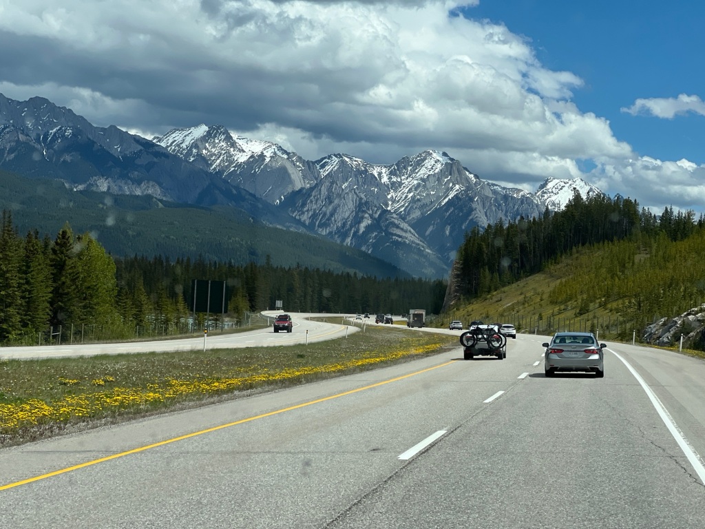
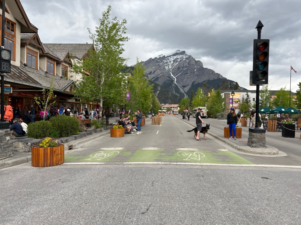
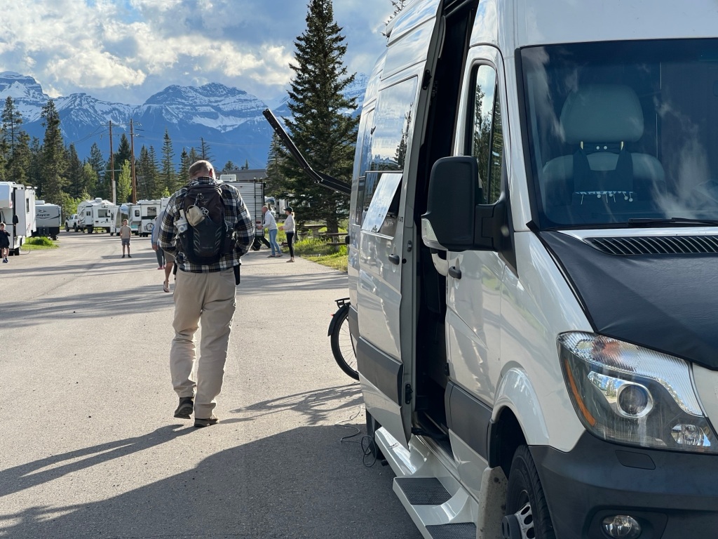
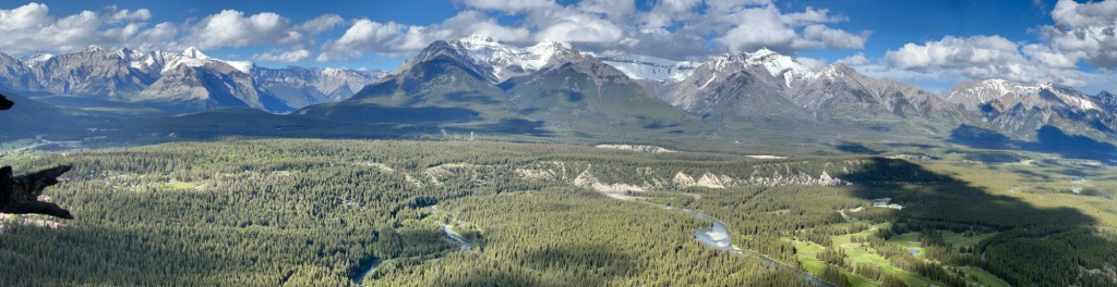
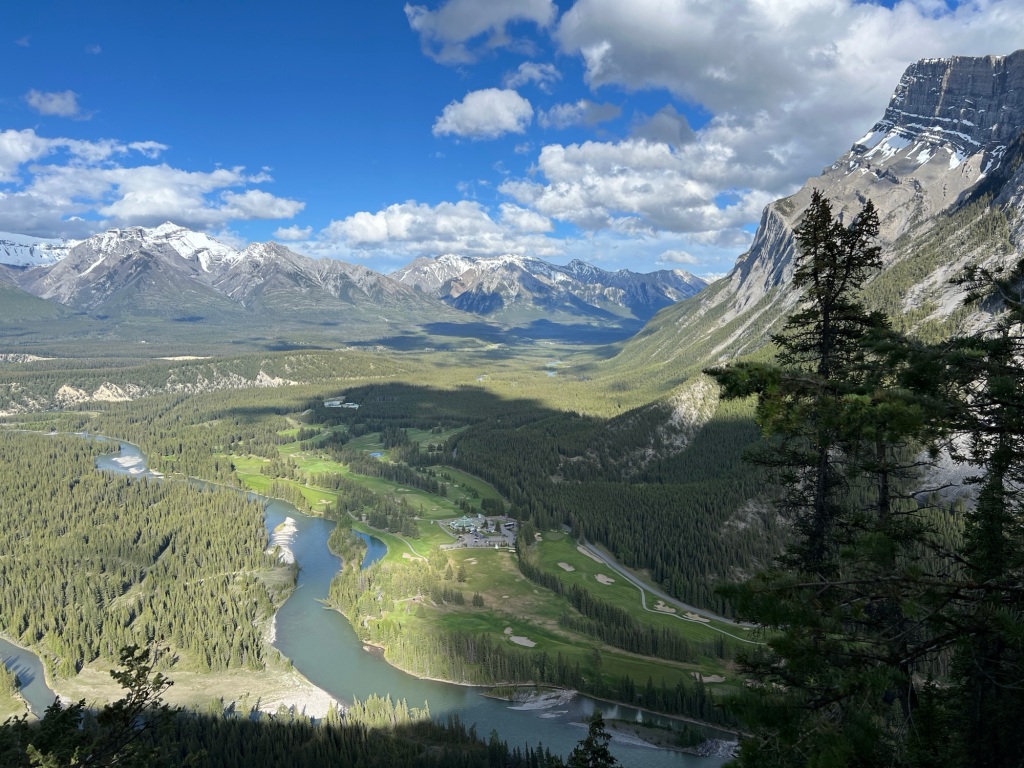
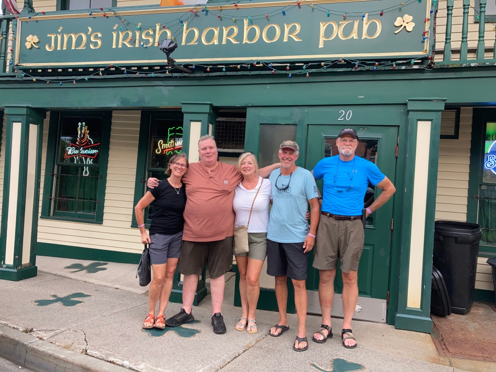
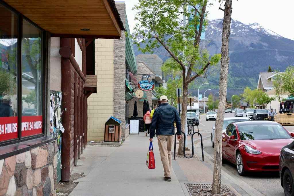
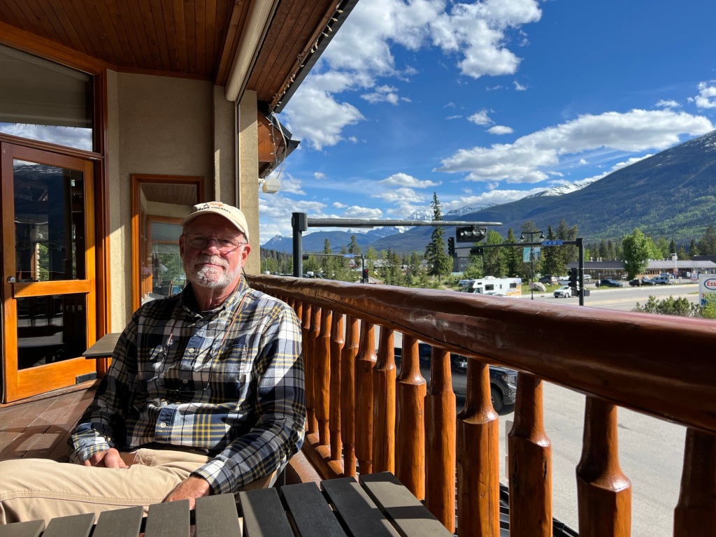
Jasper has become one of my favorite places. It’s beautiful, has great restaurants, shopping, convenient bike paths, hiking trails and camping. It has all the amenities of a tourist town without feeling like one. I’m sure it’s bustling in summer but right now it’s perfect. We are both ready to spend a couple days in one place after traveling for the last 10 days and this is the perfect place to do it.

I also have an affinity for Canadian culture. There a general feeling of peace rather than division, diversity is embraced rather than discouraged and people seem more respectful of each other. I also appreciate the environmental mindset. There are as many recycling receptacles as waste cans. So many reasons to love it.

Bike path to town

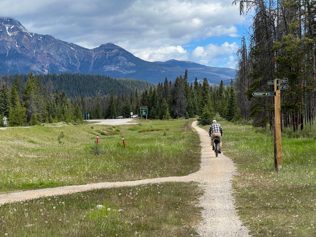
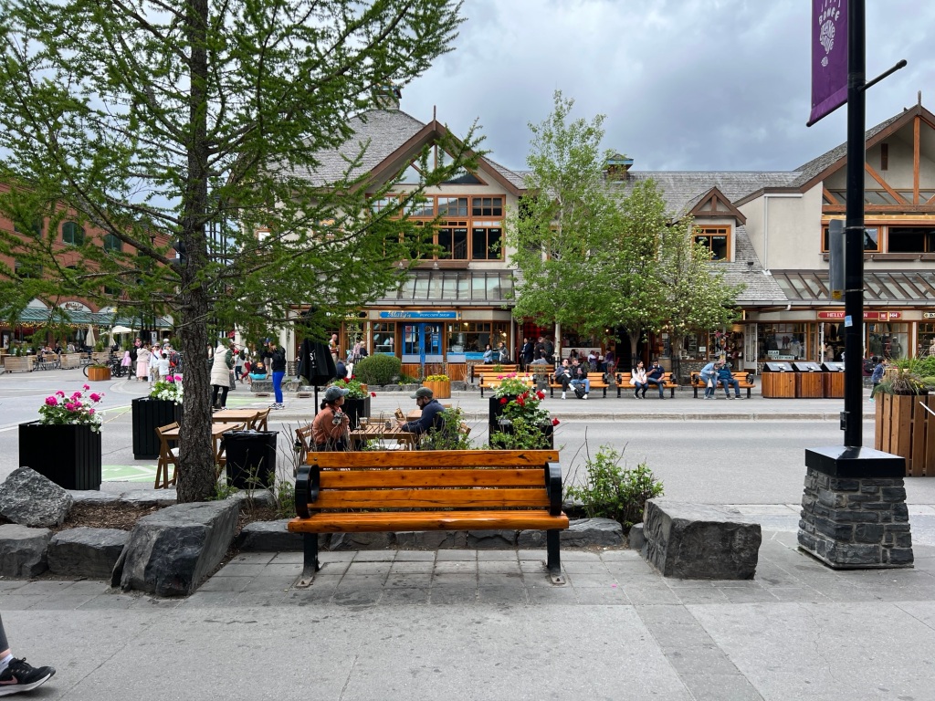
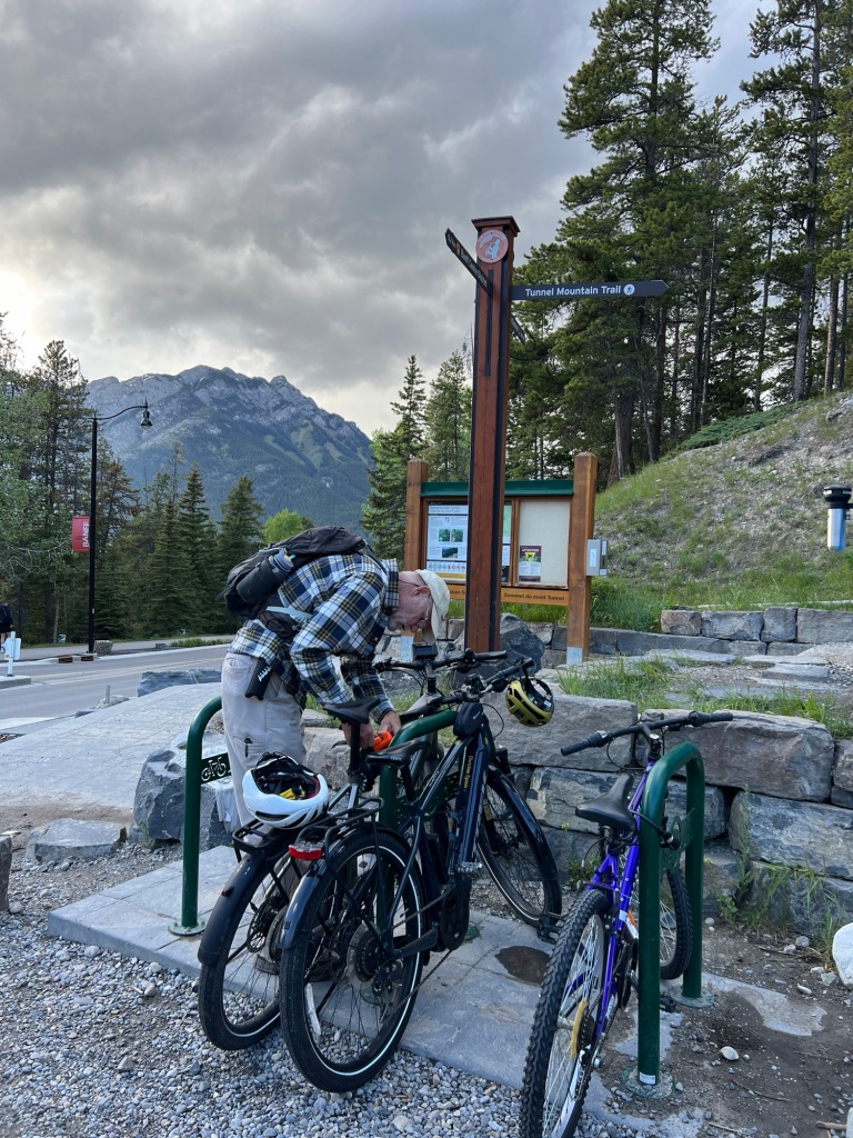
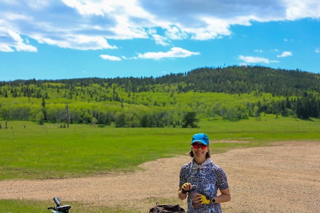
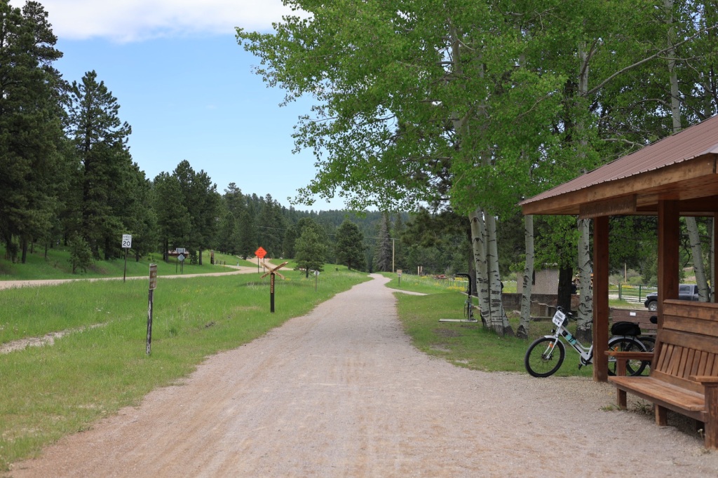
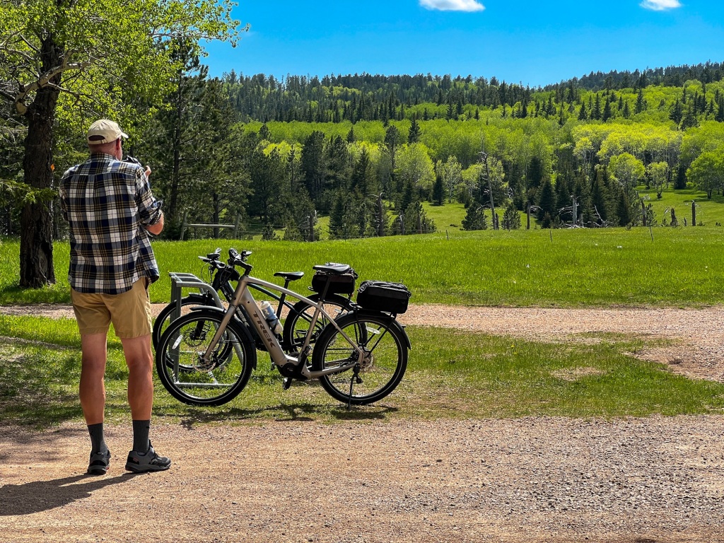
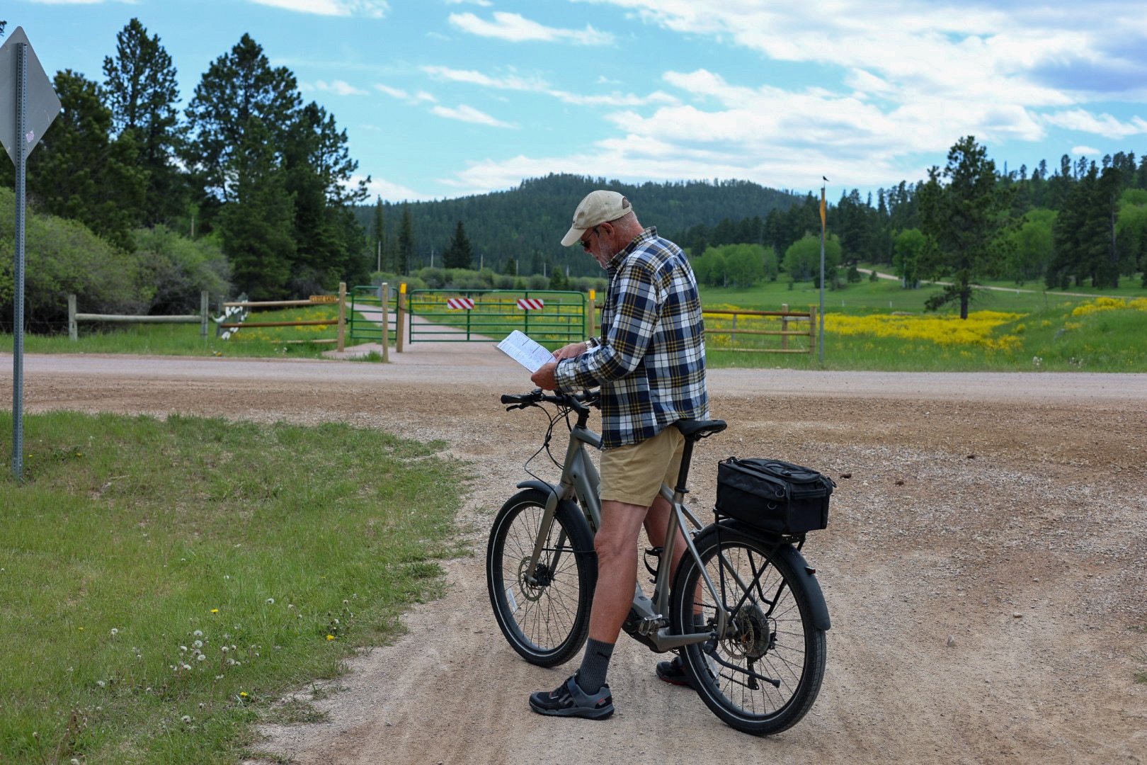
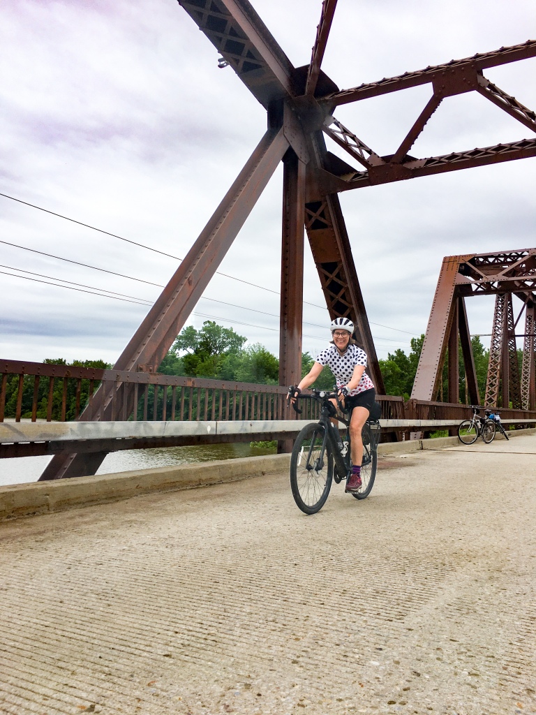
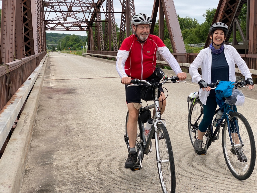
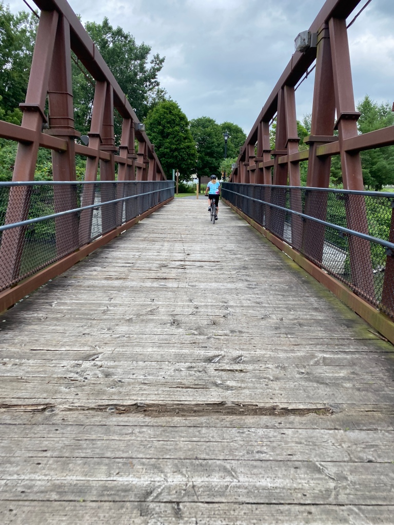
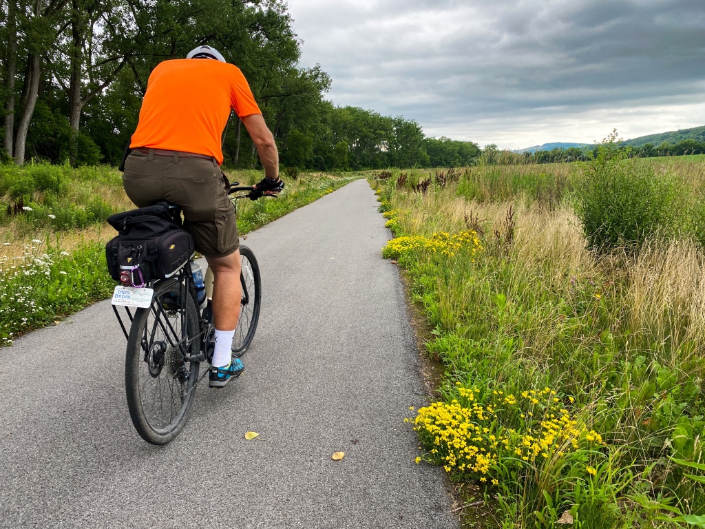
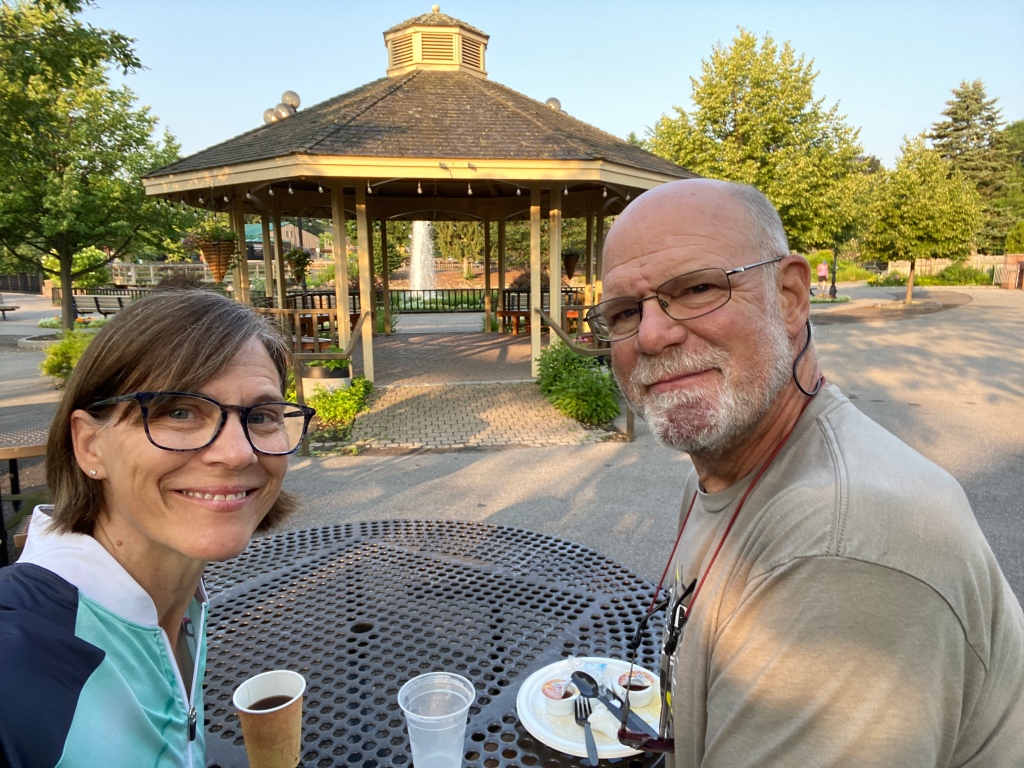
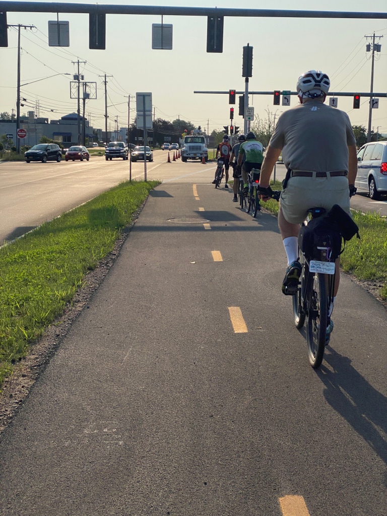
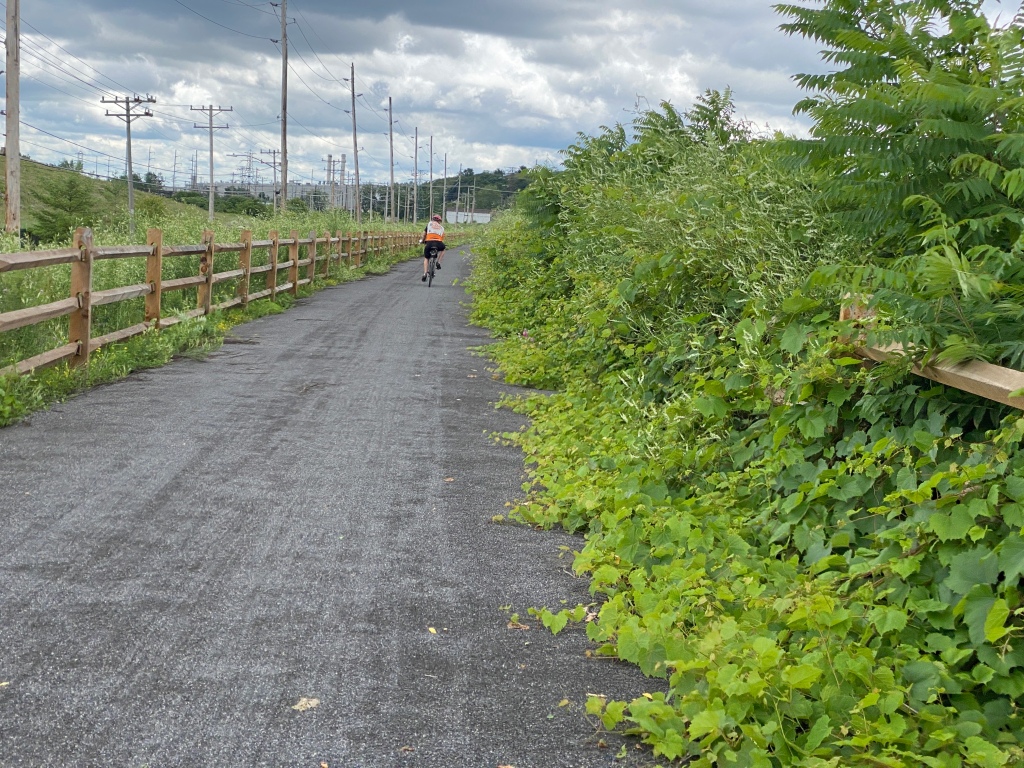
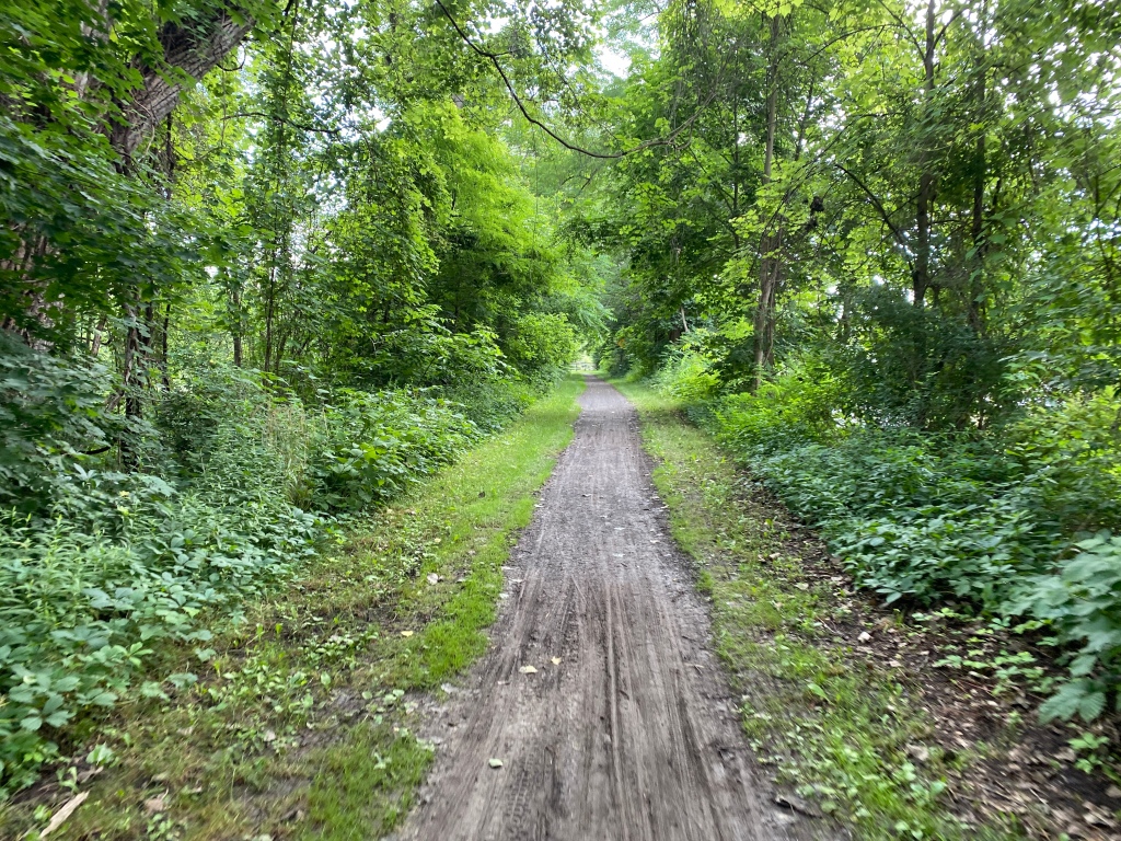
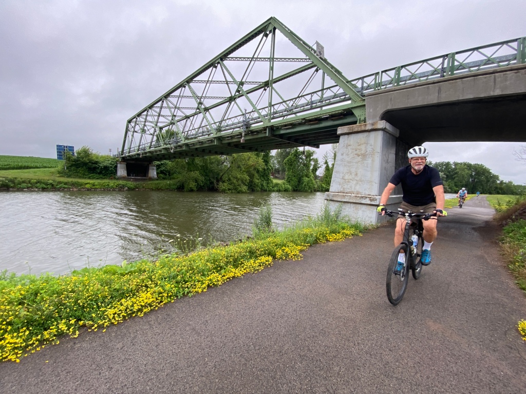
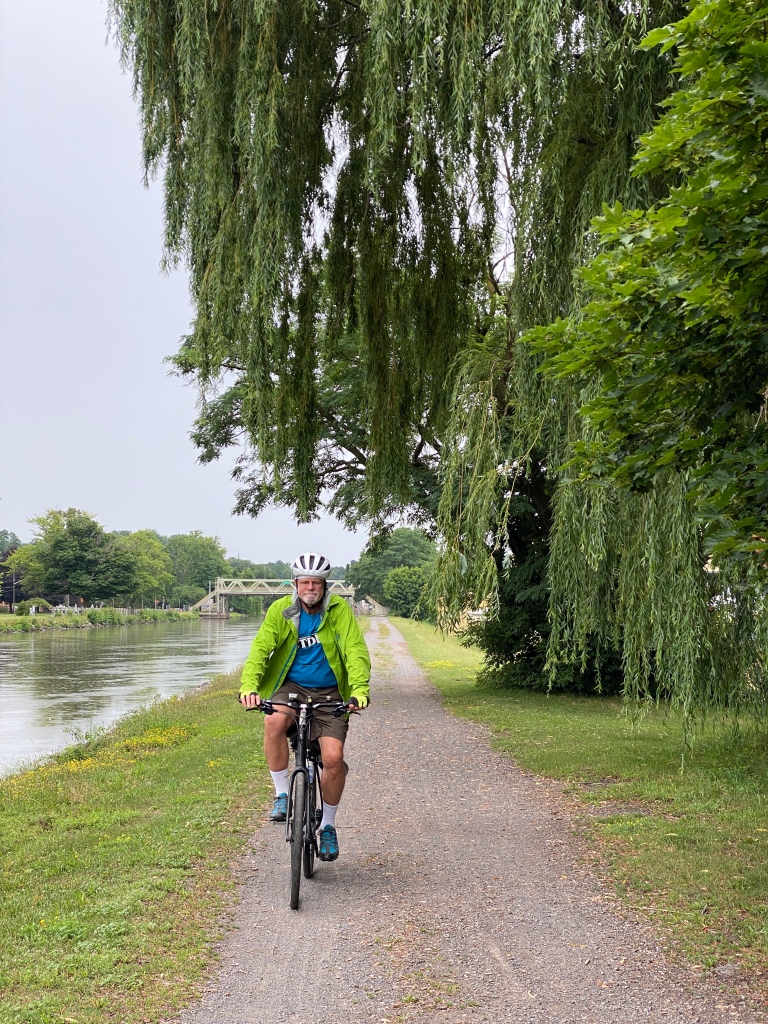
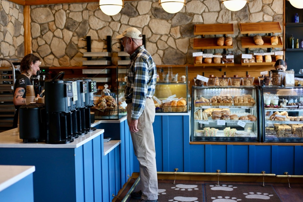
After breakfast, Riley and I rode about 3 miles on the bike path that connects the campground with downtown Jasper. It’s so convenient to have a dedicated trail instead of sharing the road with other traffic. We spent the morning shopping and walking around town. There are several nice outdoor clothing stores, some upscale specialty shops and the expected t-shirt and souvenir stores. Shopping wouldn’t be complete without a stop at Bear Claw Bakery for a sticky bun and (of course) a big glass of cold milk.

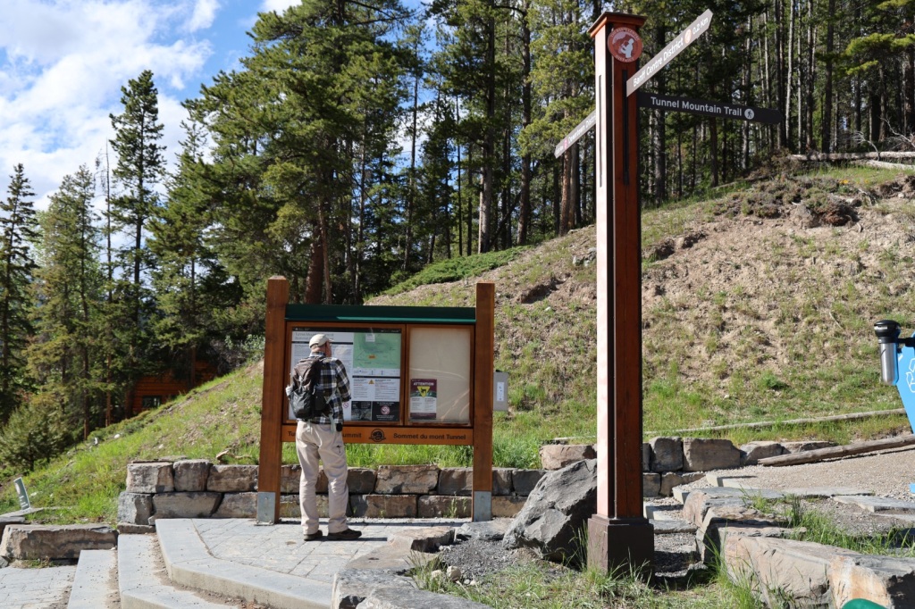
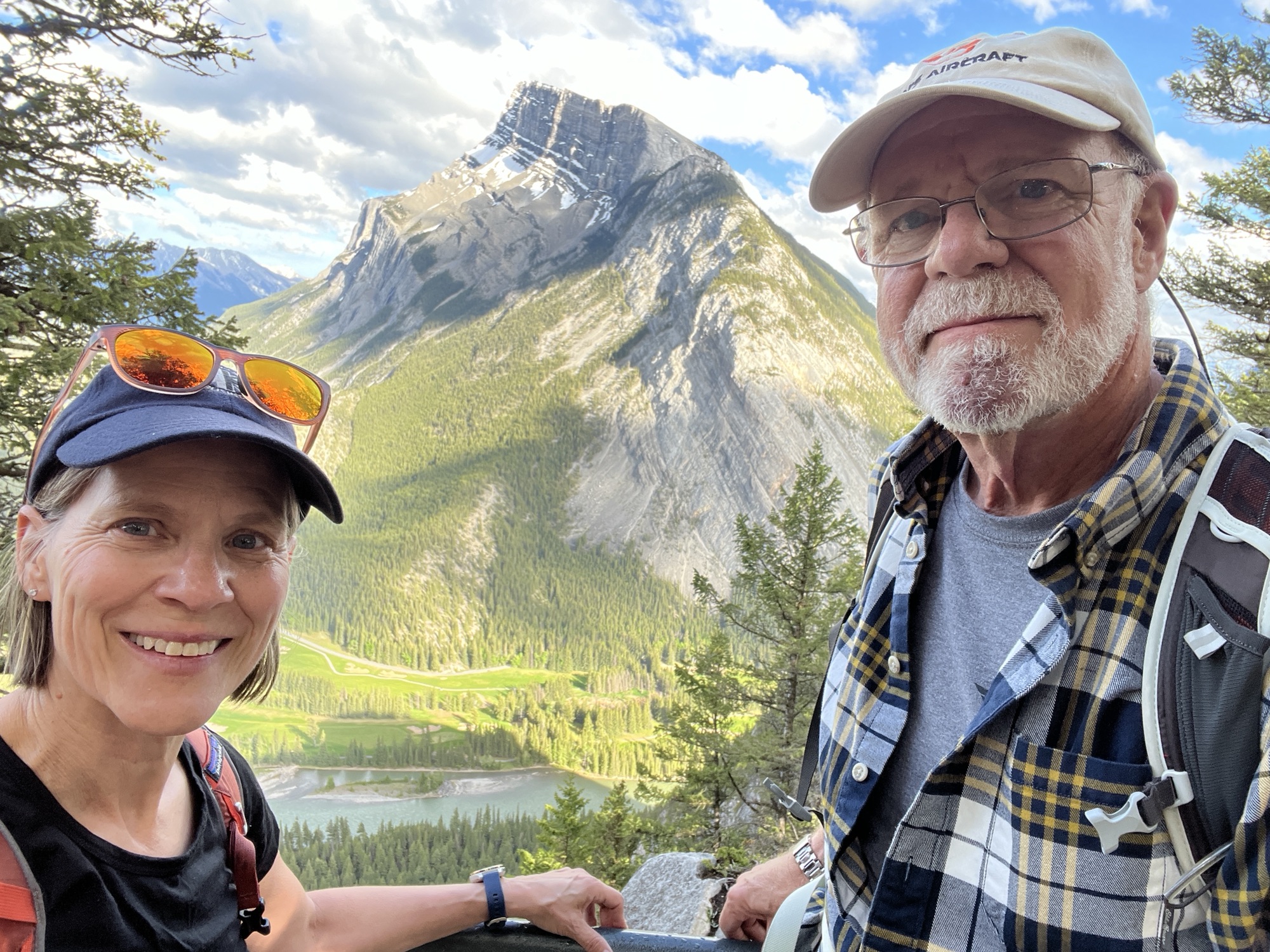
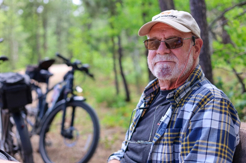
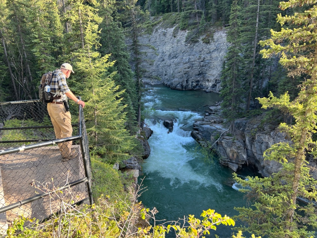
Later, we went back to camp to relax and plan how to spend the rest of the day. There are lots of hiking options in the Maligne Valley just a short drive away. Riley looked up details on the AllTrails app and we decided on the Maligne Canyon loop to Sixth Bridge, a 5-mile hike along a deep gorge with several footbridges that cross the river.

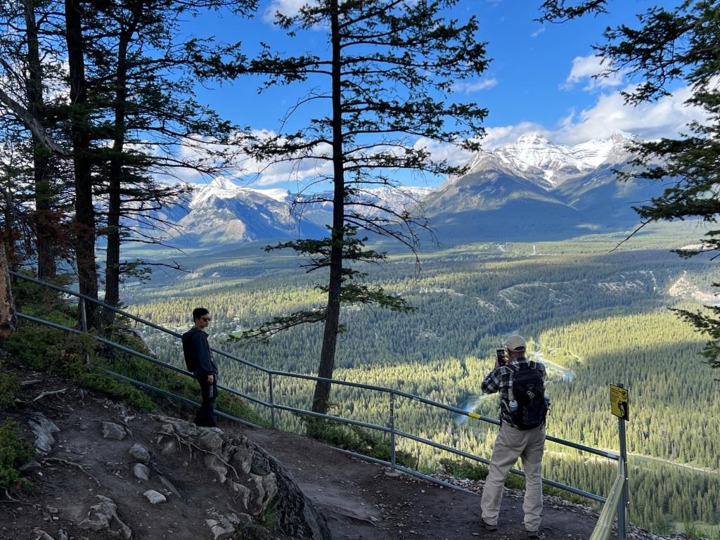
We opted to wait until evening to avoid the crowds. Parking is limited and Charlie takes up a lot of space so we didn’t want to risk driving all the way out there and have nowhere to park. This time of year days are really long so daylight won’t be a problem. The sun won’t set today until around 10:15 PM.

After a nice dinner in town, we drove to the trailhead. Other hikers recommended hiking in a counterclockwise direction to save the best for last. That sounded like good advice, so we set out around 6:45 PM for the 2 hour hike.

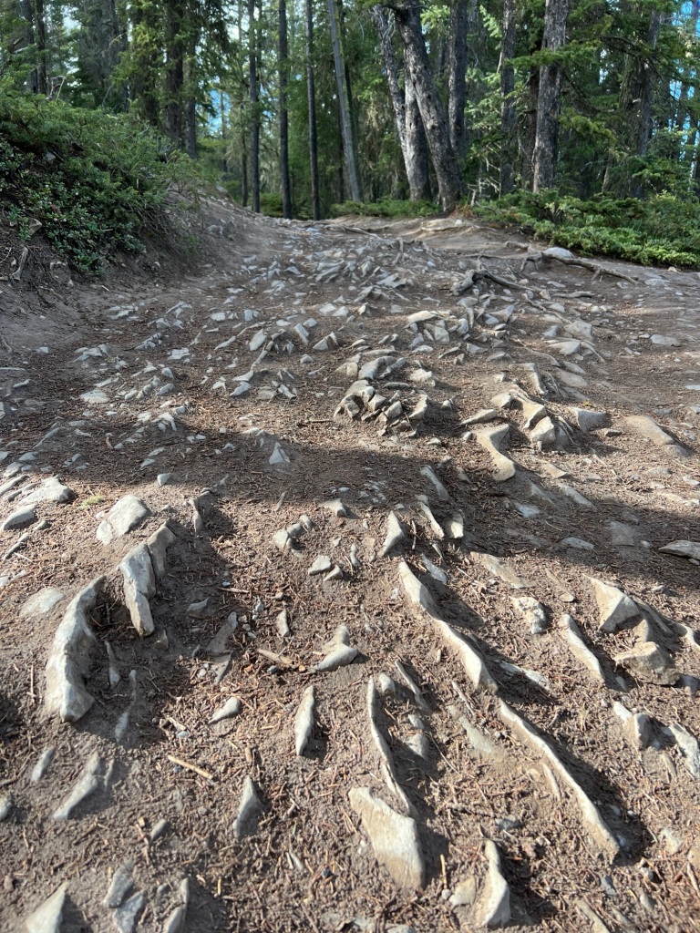
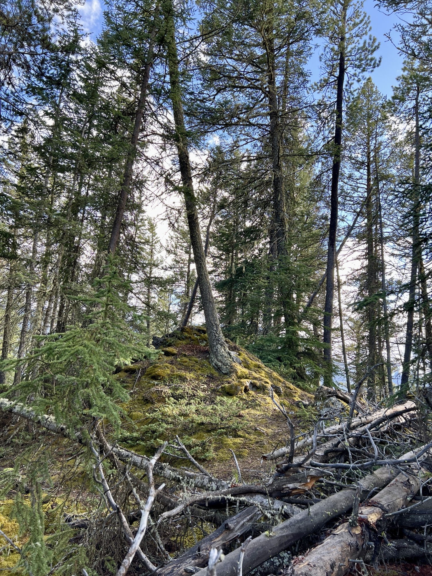
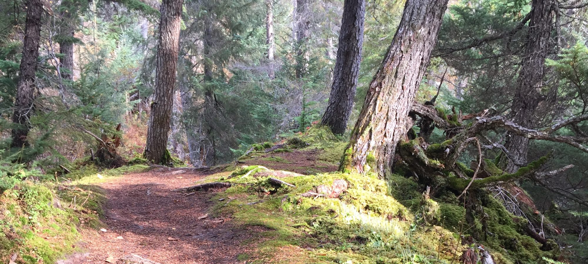
The trail was hard packed and dusty but you could see that it’s really mucky when it’s wet. There were lots of foot-sized depressions in several long stretches where people have slogged through the mud. I’m glad the sun’s been shining all day and everything is very dry.

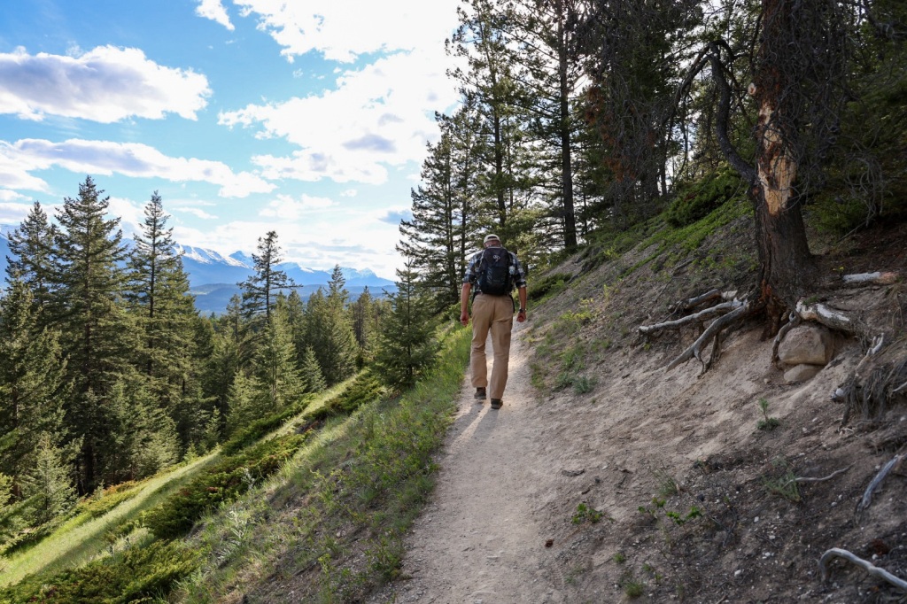
The trail wound through the woods and gradually descended to follow the river. The last bit was pretty steep with loose gravel and a thick layer of loose, powdery, dirt. I was glad we wouldn’t return on the same path.

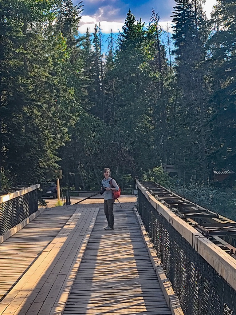
Sixth bridge, the first we encountered, spans a wide section of the river. The aqua colored water is so clear you can see the rocks and sand on the bottom even in the deepest water.

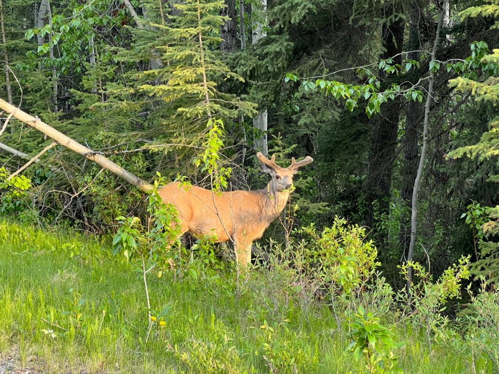
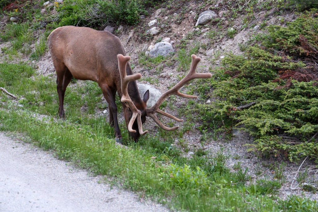
A large elk was standing on the far end of the bridge and two more standing on the opposite river bank not far from a family sitting down for dinner at a picnic table nearby.

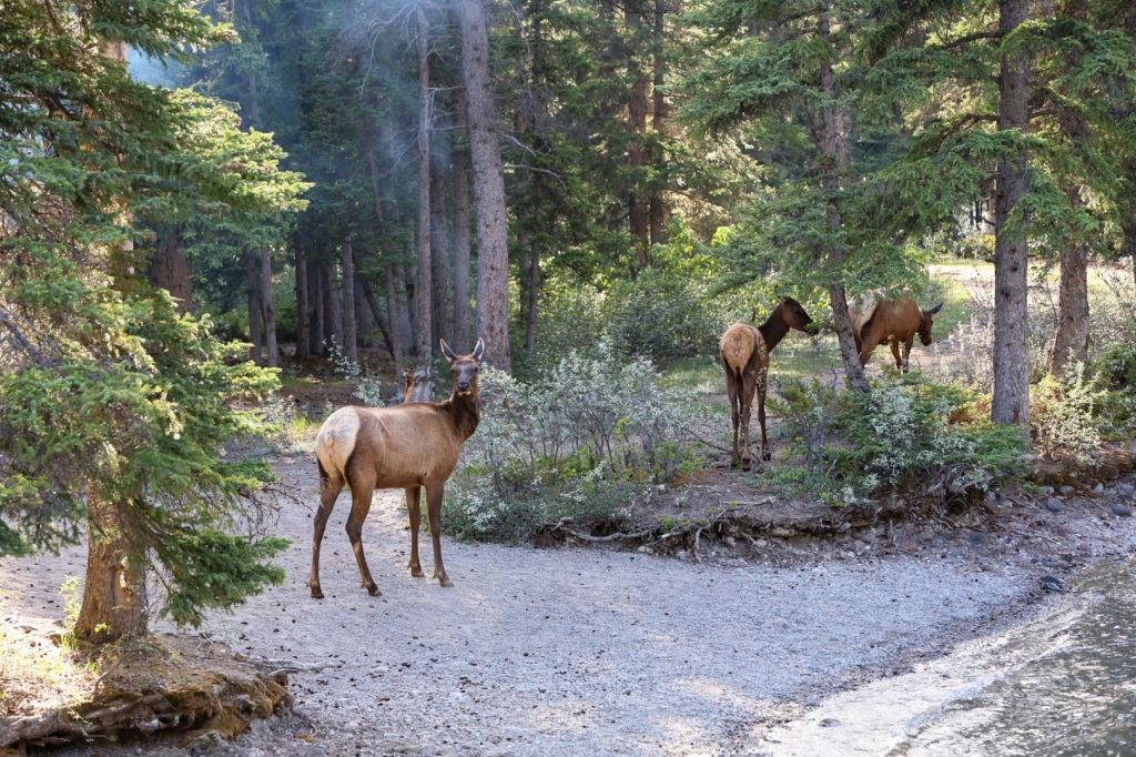
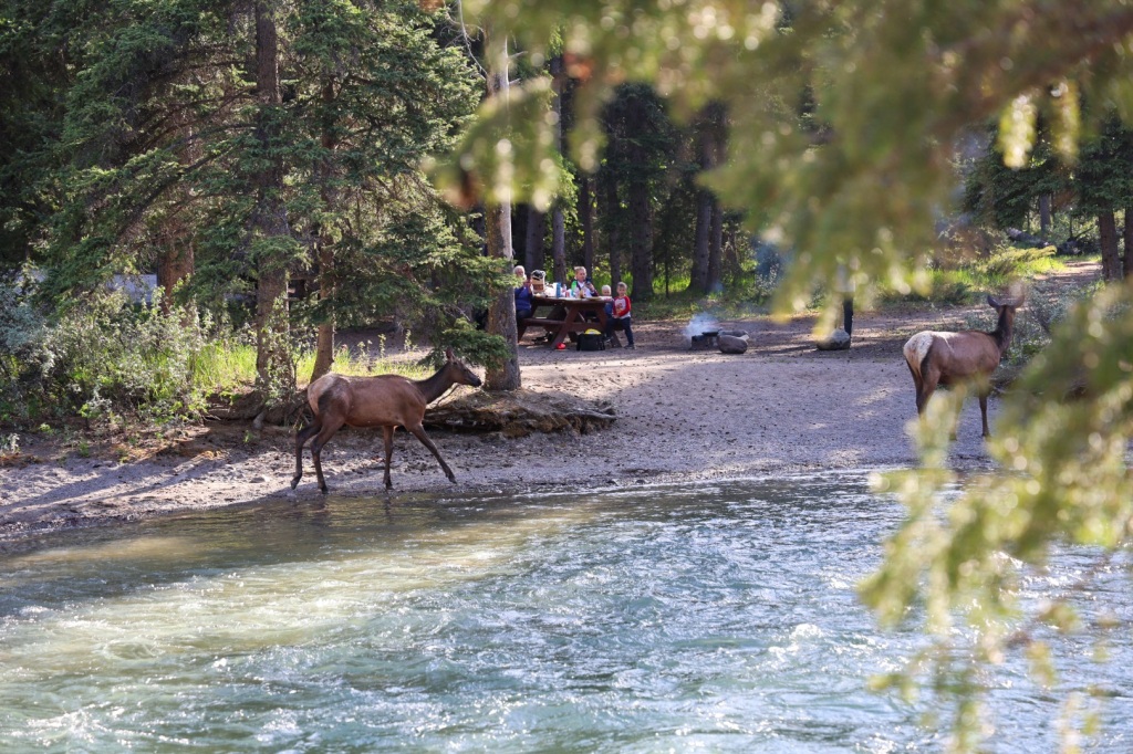
We watched and waited until they wandered into the woods down river. They were the only wildlife we’d seen so far, but we’d been keeping an eye out expecting it, especially this time of evening. Riley was carrying bear spray just in case.

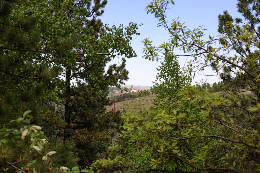
The view from Fifth bridge didn’t quite live up to the hype we’d read about and I began to doubt this hike was such a great choice. While nice, it didn’t seem particularly impressive.

It wasn’t until a bit further up the trail that I looked back and realized the view of Fifth bridge is what they were talking about. The river flowing under the bridge with snow capped mountains in the background was just beautiful. Photographs don’t do it justice.

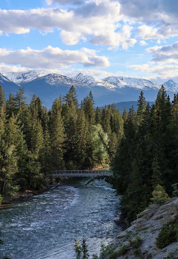
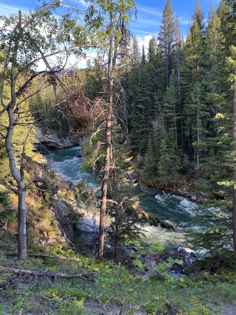
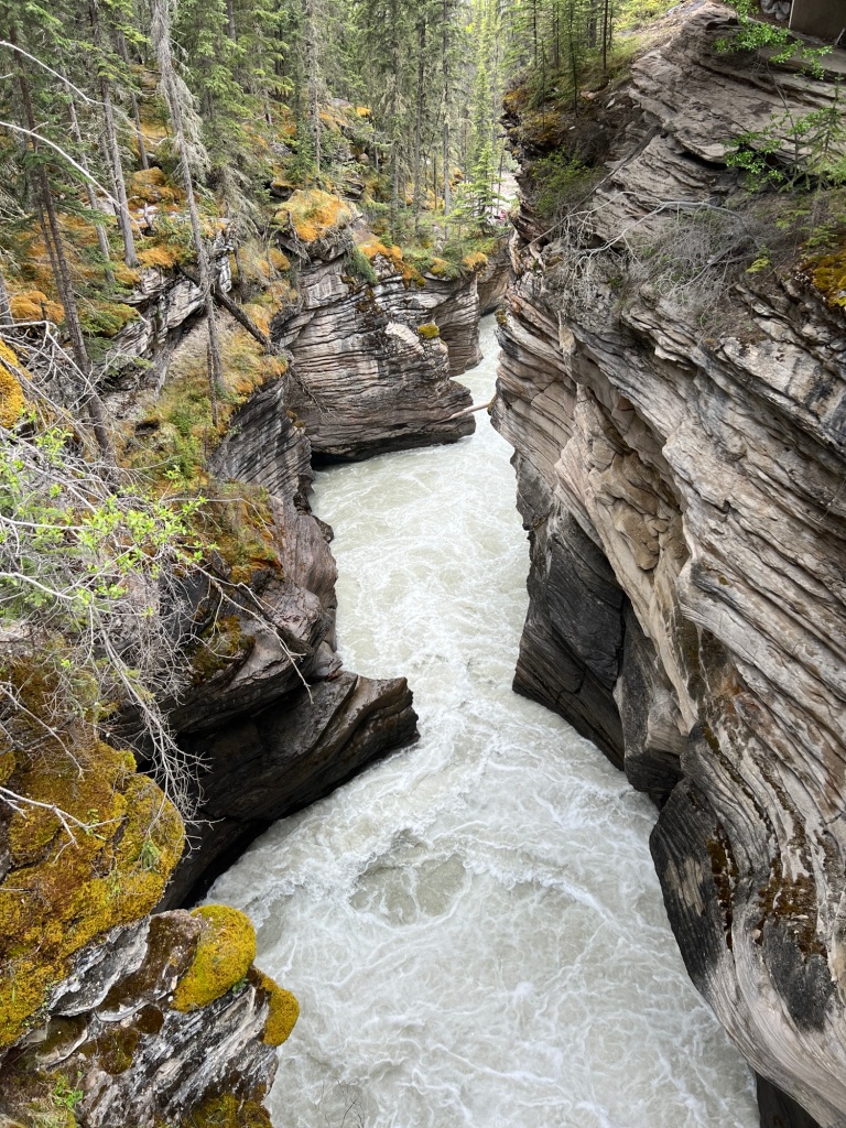
The views became increasingly more dramatic the further up the canyon we climbed. Water from Maligne Lake and Medicine Lake feed the river rushing through the narrow canyon. As the canyon narrowed, the volume of water per second increased. You could almost feel the roar of the water, especially standing on the bridges and overlooks.

The winding, twisty canyon walls are more than 50’ high. Rounded, carved out sections in the walls are created by rocks and sand carried by the rushing water. These potholes are aptly named.

We saw boulders suspended high up between the canyon walls. Erosion will eventually cause the chock rocks to crash into the river below. Dead trees that have fallen into the river collect in narrow spots creating choke points but the water still finds a way.

Evening was definitely the right choice for this hike. We encountered just three groups of people on the entire trail. A father and his young son walked the last bit with us. It was heartwarming to observe them as we examined fossil remains in a stone alongside the river. The boy was excited when he realized he was seeing the remains of a gastropod from 366 million years ago.

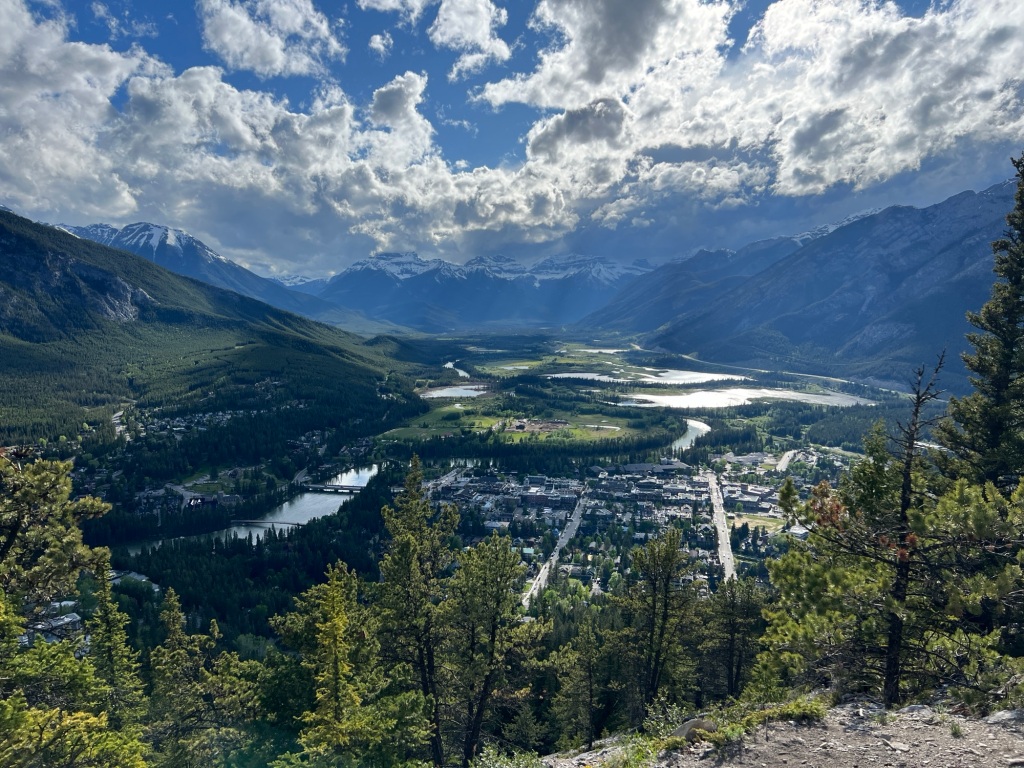
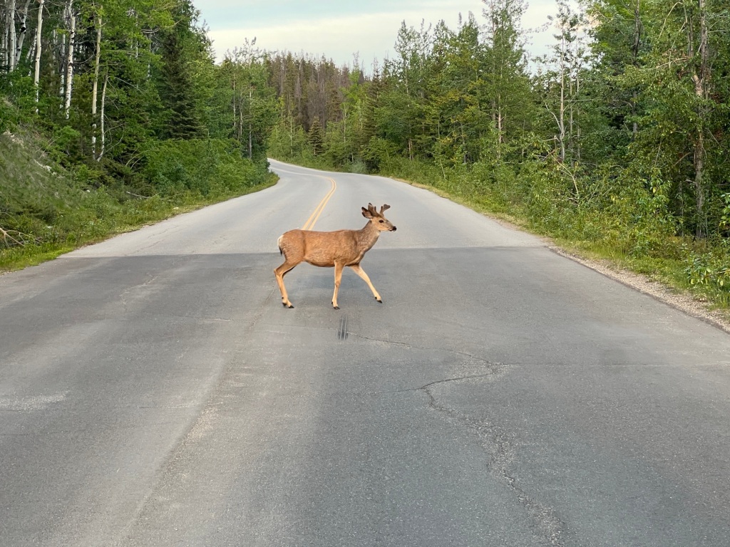
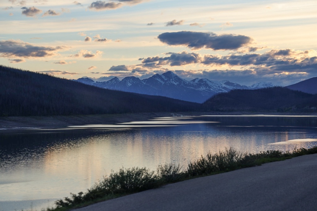
With an hour of daylight left, we thought we might have time to drive to Maligne Lake in time for sunset. The drive was longer than we expected, partly due to the increased likelihood of animals in the roadway that time of day. We drove past Medicine Lake but turned around shortly afterward to make our way back to camp.

Medicine Lake at sunset

It was after midnight by the time we showered and watched an episode of Foyle’s War (thanks for the DVDs Paige!). That’s the latest we’ve stayed up so far. I’m sure we’ll have later and later bedtimes as we travel north. It’s only one week until Summer Solstice!

Tomorrow we’ll be back on the road headed to Dawson Creek, BC.

Canadian Rockies (Banff, bears and beautiful views 3,117 miles )

After a short drive to the Canadian border crossing , we left Idaho behind and began the most exciting part of our journey.

The checkpoint was quick and easy. We’d read stories from other travelers of having their RVs searched by border agents so we were prepared for the same. The officer was very friendly and asked only if we had excessive amounts of alcohol or cigarettes, any firearms or ammunition, where we were going, how long we’d be in Canada and why we’d chosen this route since we live on the East Coast. That was it.

First look at the Canadian Rockies

The drive over the next few days will take us through the Canadian Rockies with the first night at Tunnel Mountain Village II in Banff National Park.

We arrived in Banff in the early afternoon and stopped downtown to check it out before going to the campground. It’s a cute town, but super touristy and crowded. I can’t imagine how it must be in the middle of high season.

We found on street parking without too much trouble and walked over to a nearby bakery. Well, actually we went to two different bakeries. The first had fresh bread but the pastry case was nearly empty, as any decent bakery should be this time of day. Fortunately there was another around the corner with one last cinnamon roll just for Riley.

Tunnel Village campground is one of the oddest places we’ve stayed. The sites are basically parallel parking spaces on either side of the roads running through the campground. A picnic table and water and electric hookups are in the grass beside the road. So odd.

But, you can’t complain about the view!

You can see other campers lined up and down the road

The weather on the drive in was mostly rainy and cool. I wore jeans for the first time this trip and pulled our jackets out of the closet. We felt lucky that it cleared up about the time we arrived in Banff but it wasn’t long before we realized just how quickly the weather changes here. It literally would be sunny and almost feel like summer one minute and dark skies, cold wind, lightening and rain/sleet/hail the next. Then sunny bluebird skies would return moments later.

My WeatherBug app said no rain was expected for the next couple hours so around 5:30 or so we hopped on our bikes and rode back to town to hike the Tunnel Mountain trail. The trail is about a 3 mile round trip to the summit of Tunnel Mountain, with great views of Banff and surrounding area.

There were as many trail runners as hikers, running up and down past us on the rocky trail. I’m sure it’s a standard route for local runners. One fellow passed us three times, twice going up and one going down. Riley said the only way he’d run that trail is while wearing a RedMan suit. If you’re like me and don’t know what that is, look it up. I’m betting if he had one he still wouldn’t run up or down the trail. Haha.

Tunnel Mountain was named by the railroad when they were mapping out the route through the Rockies because they thought they’d need to tunnel through it. Ultimately they decided to go around it instead but the name stuck.

View of Banff
View from the opposite side

The sky darkened and thunder rumbled as we rode back to camp. It cleared up again in time for Riley to grill turkey burgers for dinner. He was doubtful when I suggested ground turkey instead of beef but even he agreed these were some of the best burgers we’ve had.

Storm clouds gathering again

Another storm blew through at about 9:30 and the rain and howling winds drove all the campers inside their RVs for the night. Up until then, there had been a handful of hardy campers sitting out at their fire pits bundled up in down jackets and beanies looking like they were cold in spite of the fire.

It wasn’t that the temps were super low, probably around 50 degrees, but the wind was definitely chilly. It did get down into the 30’s overnight though. Our furnace came on for the first time this trip. I hope we don’t need it for long but I’m betting it will be awhile before we’re wearing shorts again.

Our first wildlife sighting happened on the drive into Banff. A smallish black bear was walking in the woods beside the road. This morning there were four of five elk grazing in the grass between the picnic tables beside Charlie. I’m hoping we’ll see a lot more!

The Black Hills of South Dakota

It’s been six days since we left North Carolina and travelled 2,099 miles across the Midwest. Today reminds me how much I love the landscape of South Dakota and Wyoming. Wide open skies and rolling green hills as far as you can see. Pictures just cannot convey the depth and breadth of what I see with my eyes.

We’d seen billboards advertising Wall Drug Store for more than 256 miles traveling on I-90 W so naturally, we had to stop when we finally drove through Wall, SD just outside the Badlands. If you’ve ever been to South of the Border on I-95 in South Carolina you have a good idea what it’s like. Just imagine 76,000 sq feet of cowboy Wild West themed clothing, boots, artwork, activities, dining and souvenirs.

As tempting as I know all this sounds, we managed to leave without buying anything other than some donuts and a cinnamon roll.

The backstory is kind of interesting. Dorothy and Ted Hustead bought the only drugstore in Wall, SD in 1931. Five years later the business hadn’t grown much. On a sweltering July day, Dorothy had the great idea to put signs out on the highway advertising FREE ICE WATER to passing motorists. The rest is history. The billboard advertising campaign continues almost 100 years later. The farthest sign is a 394-mile drive away, 300 signs in total. Well, I guess if you find something that works, stick with it!

Looking at the day’s driving route to Sheridan, Wyoming, I realized another rails to trails bike trail I’ve heard about is just a short detour off the interstate. The George S. Mickelson Trail in the Black Hills of South Dakota is listed on the Rails to Trails Conservancy Hall of Fame. After riding a portion of it I can understand why. It’s gorgeous.

The 109-mile trail was once part of the Burlington Northern Railroad. The gravel trail runs through scenic, mountainous, Black Hills National Forest. We rode a 24-mile out and back from the Kirk Trailhead south of Lead, SD to the Dumont Trailhead north of Rochford.

The trail was partly shaded by the ponderosa pines, aspen, birch, oak and spruce trees that make up the forest. I’d love to see it in the fall when the aspens turn gold. A cool breeze helped temper the heat from the sunshine and the exertion from pedaling our bikes.

We stopped for a picnic lunch at a bench beside the trail near a marker pointing out a mine situated on top of the mountain in the distance. We’d noticed it on the drive in and wondered what kind of mine it was. The Homestake Mine in Lead, SD was a gold mine until it closed in 2002. According to Wikipedia, it was the largest and deepest (8,000 feet) gold mine in the Western Hemisphere, producing more than 43,900,000 oz of gold during its lifetime. That’s equivalent to 2,500 cubic feet of gold!

Homestake Mine

Since 2007, the Homestake Mine has been the location for the National Science Foundation’s Deep Underground Science and Engineering Laboratory (DUSEL). That’s not the first time the mine has been used for scientific purposes.

The Homestake Mine is famous in scientific circles because of the work of a deep underground laboratory that was established there in the mid-1960s. This was the site where the solar neutrino problem was first discovered, in what is known as the Homestake Experiment

A Park Ranger checking park passes waved for us to stop as we passed through the Englewood Trailhead. We‘d seen the self-pay registration kiosk where we’d parked, only because we were looking for the trail map. The fee is $4.00 per person, cash only. Having exactly four dollar bills and a few $20’s, we folded up the dollar bills, sealed it in the envelope and figured that was close enough as we dropped it in the slot. Instead of carrying the customer copy of the single permit with us, we left it in Charlie. Uh,oh. Busted!

I told the ranger we’d thought the permit was supposed to be on the vehicle (leaving out the part that we’d only paid for one person). She looked at me like I was either lying or an idiot and explained that the permit clearly says “Keep it with you while on the trail, as pass must be offered for inspection when requested.” Pointing to a man sitting in a truck a few yards away, she said “I’ll let you go with a friendly reminder, but he’s the CO and wouldn’t be so forgiving.” We rode on, thankful we didn’t get pressed further.

I was feeling guilty as we rode the remaining miles to Dumont Trailhead and hoped there would be someone there who could break a $20 for us and we’d just pay for two new passes and everything would be squared away. But…. no luck. Also, who carries cash anymore anyway?

Dumont Trailhead

I looked online to see how much the fine for riding without a permit would be when I saw an option to buy permits online. Great! Following the link, I discovered the only Mickelson Trail permit available is an Annual Pass, not the $4 daily pass. I figured the $17 fee is probably less than the fine. The confirmation email says I can expect my annual pass to show up in the mailbox at home in 14 days. I guess we’ll have to return in the fall to see the leaves for sure now. Ha ha!

The first 12 miles was nearly all uphill. My Garmin said we’d gained 1,539 feet in elevation and I didn’t doubt it. My quads were aching by the time we reached the summit a mile or so from the Dumont Trailhead. I was envious of the smiling cyclists coasting downhill past us as we pedaled the inclines. The payoff for the long climb was a fast and fun ride back.

We coasted pretty much the entire way back, sometimes as fast as 21mph. A shorter, steeper alternate route veers off to the right between the Englewood and Kirk trailheads. An information sign warned of a steep 1/4 mile section with 17% grade. We opted for this route rather than repeating in the same section we’d ridden earlier.

I sailed down the gravel path, standing on my pedals and gripping the handlebars. Riley zoomed ahead, as we sped down the hill. I heard my water bottle skitter across the road behind me as I rounded a sharp turn and knew immediately what had happened. I stopped at the bottom of the hill and ran back up to retrieve it and made sure it was secured tightly before hopping back on the trail. I knew Riley would be worried when he realized I wasn’t behind him anymore so I tried to catch up as quickly as I could.

Before long I saw him riding back up the hill with a worried and then relieved look when I told him only the water bottle took a tumble. Visions of Matt’s mountain biking accident a couple years ago danced in his head. Broken bones and gravel rash are not what we need on this trip!

Kirk spur

The Kirk spur had some of the most beautiful scenery. We rode across three new trestles over Whitewood Creek and through impressive rock formations. It was pure luck that we’d chosen to start out on the path we did. It would have been a real challenge to ride UP that steep hill.

It was late evening when we arrived at the KOA in Sheridan, WY. Riley grilled pork chops and buttered french bread while I prepared a side of limas and corn for dinner.

We sat at the picnic table eating dinner as the day turned to night, thinking how lucky we are.

Aktá Lakota Museum, South Dakota (1,662 total miles)

The landscape began to change as we made our way across South Dakota today. The weather changed too. The temperature is much cooler, partly due to a cold front bringing rain for most of the morning until early afternoon. I changed into long pants and grabbed a jacket when we stopped for lunch in Chamberlain, SD.

Chamberlain is a small town on the banks of the Missouri River where Lewis and Clark stopped in 1802 on their expedition to the Pacific Ocean. The views across the plains are gorgeous with rolling hills on the opposite side of the river. Everything is so green and so wide open it seems like you can see forever.

We saw the sign for Mi Pueblo (not the same chain as back home) and thought Mexican food sounded like a good choice. I guess it’s just as well that the food wasn’t great given how long we’ve been sitting. It’s not that hard to resist a mediocre basket of chips and salsa.

After lunch we toured the Atká Lakota Museum and Cultural Center in downtown Chamberlain. I’d seen it on Google maps and hoped it would be open when we came through. The museum does an excellent job of illustrating the history and culture of the Lakota people who originally inhabited the Northern Plains. It’s fascinating to learn about how they lived, the different roles for men and women (equally important) and to see many artifacts from the 1800’s. The intricate beadwork on clothing, bags, and moccasins was especially impressive.

We bought a beautiful Star quilt made by Carla Thomas, one of a small group of Lakota quitters who make quilts to sell at the museum shop. A network of elders construct the quilt top and Carla hand stitches the quilt. It’s just what we needed for the bed in Charlie. It fits perfectly!

The true history of the American West is much different from what I was taught in school. I’m glad there places like this that tell the stories of indigenous peoples.

The rain stopped just in time for us to get an up close look at Dignity of the Earth and Sky, a 50’ tall monument to honor the Lakota and Dakota people. She stands on a bluff overlooking the Missouri River near downtown Chamberlain. Such an impressive sight.

Sunshine and blue skies brought warmer temperatures so I was back in shorts by the afternoon.

New Frontier Campground is located in the very small town of Presho, SD right off Interstate 90. The sites are well spaced with lots of trees, green grass and a nice bathhouse. I was more than ready for a spacious shower and shampoo after a couple days with just the small bathroom in Charlie. Ahhhhh.

Following the recommendation of our campground host, we rode our bikes into town for dinner at the Jet Lanes Bowling Alley. They’re known for the “best burgers in town!”. That’s probably true. Based on what we saw, it’s the only place to eat in town. Plus, the parking lot, bar and dining room were pretty full when we got there.

The food actually was pretty good. We shared a ribeye steak dinner and salad bar. After dinner we rode out to the Municipal Airport down a long gravel road past the bowling alley. The gate was open but no one was around. We watched a crop duster flying low over the fields for a few minutes before riding back to camp.

The night air turned chilly again. We slept soundly, snuggled up and warm under our new Star quilt.

High Trestle Trail and driving adventures (1,317 miles so far)

I’ve been wanting to ride on the High Trestle Trail for years since seeing pictures of it in numerous rails-to-trails bike publications. I was excited to see how close it is to our planned route and happily stuck an “additional stop”pin at the trailhead in Madrid, IA, roughly halfway through Thursday’s Google maps driving directions.

The trail runs from Ankeny to Woodward in central Iowa and was once part of the Milwaukee Road railway. The most interesting feature is the 40 meter high and nearly half mile long trestle bridge over the Des Moines River. The bridge is located near mining shafts worked by Italian immigrant families that settled nearby. The structure over the bridge is meant to resemble the view through a mine shaft and is illuminated with blue lights every night. I had hoped to see it at night but didn’t make sense to stay here overnight.

We rode 12 or so miles on the trail, turning around at the terminus in Woodward and then back to an ice cream shop in downtown Madrid recommended by a local fellow out enjoying the bike trail. The weather was great except for a stout wind, particularly in the middle of the bridge where we had to hold on to our hats lest they end up floating down the river. It’s been very windy all day.

Today was my turn to drive giving Riley a chance to chill out and mindlessly scroll on his phone or Wikipedia interesting road signs as we drove along the highways. Did you know there’s a town named What Cheer, IA? What did we do before we had all the world’s information at our fingertips?

I really enjoy driving Charlie. Because I don’t drive as often as Riley does, the first few minutes are always a little intense. I’m hyper aware of the length, height and weight of the fully loaded van so it takes a bit to get comfortable with maneuvering in traffic and relearning acceleration and stopping distances. It wasn’t long before it felt perfectly normal and I settled in to the drive.

Time and miles go by faster when you’re concentrating and trying to keep a 24’ Sprinter van between the lines with a constant crosswind. I didn’t know that afternoon wind speeds would be 28 mph with gusts up to 44 mph when we started out. You can really feel the windbreaks created by the occasional hills on the otherwise flat drive across Iowa. I had to constantly steer against the wind, especially on the two lane highways through the countryside.

After the bike ride, we drove west on Iowa Highway 141 to Missouri Valley where we hoped to find a campsite at Missouri Valley City Park, a first-come no-reservations campground. We decided to take the scenic route rather than more boring interstate driving. About an hour into the drive, we heard a loud BEEP and cruise control suddenly turned off and “ESP Visit workshop” appeared on the display. Oh great, just what we need on the 4th day of a 2 month roadtrip.

Electronic Stability Program is a Mercedes feature meant to help stabilize the vehicle primarily by controlling the speed each wheel is turning so it remains stable and forward facing. Sometimes a failure in one of these systems causes the vehicle to go into limp mode which limits your max speed to 30-45 mph. We had a similar experience with the check engine light a few years ago driving through Wyoming and had to stop at a Mercedes dealer in Great Falls, SD for service.

Riley called Mercedes Sprinter service centers in Sioux Falls, SD and Billings, MT to see if we could schedule an appointment in the next few days. Everyone is short staffed, with the earliest appointment available at the end of the month! Perfect. The service manager in Billings said he has two vans belonging to people on the way to Alaska parked out back waiting to be seen right now. I guess this par for the course.

He did have a suggestion though. He said it could be as simple as bug guts and road grime obscuring the sensors on the front of the van. He said to really clean the front, paying particular attention to the emblem on the grill. He also said he didn’t think it would cause the van to go into limp mode so along as we were careful and could do without cruise control it would be fine.

Guess what? It worked! A quick stop at the car wash that conveniently had a setup for large vehicles did the trick. Not only did it solve the sensor issue, the bikes and Charlie got a much needed wash.

Feeling relieved and optimistic, we soon arrived at Missouri Valley City Park campground and found a nice spot to camp for the night. The park has a large grass square with shade trees, picnic tables and a pavilion where a local band was setting up for tonight’s free concert. Campsites are located around the outside perimeter with water and electric hookups.

All this for $15 a night! It seemed a bit less of a bargain the first time a freight train roared by on the elevated track about 40’ away from Charlie. Oh well, you get what you pay for haha.

It was a great day, in spite of the brief vehicle trouble anxiety. I’m glad we built in 3 or 4 extra days to account for unplanned delays. I’m even more thankful that we don’t need to use them now.

Day 8 – Niskayuna to Albany

The last evening at camp was nice with friends, coolers filled with beer, a decent wine selection and lots and lots of food. I feel sure I’ve replace every calorie I’ve burned this week but that only makes each bite more delicious.

The after dinner “no-talent talent show” lived up to its name with a variety of acts put on by good natured people much braver than me. There were awards for the most flat tires in a day (4), oldest rider (88 yrs) and youngest (14 yrs), bike mechanic’s best friend (frequent customer award), slowest rider and many others I can’t remember. Fun times!

Bruce channeling Johnny Cash
Catherine (seated) received the oldest rider award

Third base turned out to be a good spot for the tent because it stayed dry through the steady rain during the night. I’m glad I didn’t know ahead of time how rainy it would be, otherwise I might have changed my mind about this. Riding in the rain is not that bad, the hard part is keeping damp clothes and bedding from getting too funky. Two visits to the laundromat were essential in making it this far. A third is definitely needed now.

We awoke early, packed and loaded up our gear, ate breakfast and headed out on the bikes by 6:30 AM. It was nice to be one of the first on the trail, riding on the quiet paved path through the woods with lots of rabbits and birds, a doe feeding in the grass and a little turtle crossing the path for company.

The trail ran along the Hudson River with miles of fresh asphalt and picturesque bridges.

We made good time, briefly stopping at the rest stop about 10 miles from Albany and crossed the finish line by 9 AM.

400 miles in 8 days

I’m so glad we are able to accomplish such a big goal and had so much fun doing it.

Post-ride ice cream reward

Day 7 – Canajoharie to Niskayuna

Flying down the hill this morning way more fun than riding up it and it was a great way to start the day’s ride.

Walking down the steep grassy hill in the dark to the port-o-john in the middle of the night was less fun. I think the view on top was worth it but I think Riley disagrees.

Top of the hill. Notice the johns way in the distance in the bottom left.

The morning started with a brief downpour shortly after 5 AM, just long enough to make the tent nice and wet before we packed it up and stuffed it in a duffle. The weather cleared and stayed nice for the ride.

The only bike repair we’ve needed all week was a flat Riley discovered this morning. The timing and location really couldn’t have been better since the bike repair tent was just a few yards away.

1 flat in 300+ miles isn’t bad

Much of the trail we rode on today was new so the ride was smooth and surrounded by trees and followed along the Mohawk River for a good distance.

The first stop of the morning was 18 miles in at Old Fort Hunter. I had ridden a little ahead of Riley so I waited for him at the first turn off before the rest stop. I waited and I waited, watching cyclist after cyclist pass by with no sign of Riley. I was beginning to get irritated and then concerned, envisioning a horrible crash or some other terrible reason he hadn’t appeared when I remembered the Fresh Baked Goods sign a mile or two back beside an Amish horse and buggy just off the trail. Sure enough, here he comes around the turn with a big grin and a little sugar on his lips telling me he just ate the “best cinnamon roll he’s ever had.” Haha. And the best part is he brought one for me. I guess I can’t be too annoyed at having to wait. We toured the museum and enjoyed a few minutes off the bikes.

We continued on a short distance to Amsterdam, NY where we took a short detour to Riverlink Park which features a large scenic bridge over the Mohawk River with beautiful sculptures and artwork.

Mother and Child at the Mohawk River by Dimitar Lukanov

We continued on to the Patersonville Volunteer Fire Department for hotdogs and hamburgers, not that I was particularly hungry, but I figured if they’re going to all the trouble of having a cookout for us it was the least I could do.

Firemen are the best cooks

The trail crossed the river several times and some of the bridges were particularly pretty. Marcia snapped this photo of me so I returned the favor for her.

The next rest stop was only about 4 miles down the trail at Mabee Farm Historic Site, the oldest farm in the Mohawk Valley (1705). I couldn’t eat another thing but we did enjoy touring the farm and learning some of the history.

After that the route continued through Schenectady and finished at the Jewish Community Center in Niskayuna for a total of 46.6 miles.

After retrieving our bags from the truck we did the usual walk around trying to decide the optimal place to pitch the tent. I spied the top of a hill surrounding a ball field but Riley had enough climbing hills in the middle of the night so we opted for a high spot near third base.

An afternoon shower throughly soaked our tent while we had the rain fly hanging up to dry. Whoops. I hope it dries out before time for bed tonight.

Tonight is the end of ride celebration with the last 28 or so miles on tap for tomorrow morning. I’m kind of sad to be done but I think our sleeping pads and tent could use a little Febreeze at this point so I guess it’s just as well.

Day 6 – Rome to Canajoharie

Verona Beach State Park on the East shore of Oneida Lake was a great overnight camping spot. The park is large and shady with a long wide beach perfect for swimming or watching the sunset. It’s also very, very dark at night. Great for sleeping but not so great when you have to get up in the middle of the night to pee. I got up about 3 AM, put on my Chacos and crawled out of the tent in pitch darkness. I stood in the dark waiting for my eyes to adjust, thinking of all the reasons this was a bad idea: tripping over a tent stake, getting disoriented and not being able to find my way back, getting in the wrong tent, and briefly considered waking Riley up to go with me. I told myself not to be a baby and carefully made my way to the bathhouse about 20 yards away. The cinder block building has tiny windows and no lights at all. I had visited it earlier and knew the layout so I had no trouble finding the first stall and taking care of business in pitch darkness. It was a strange experience for sure. I retraced my footsteps, crawled in a tent that looked like mine and relieved to find the big guy sleeping inside was Riley.

We awoke at 5 AM to the sounds of caterers setting up breakfast, tent zippers opening and early risers breaking down their camps. We joined the others for egg, ham and bacon bagels, yogurt, fruit, juice and coffee then grabbed a cheese danish to stash in our packs before packing up our gear and boarding the shuttle back to Rome.

Overcast skies with highs in the mid 70’s is much better for riding the 62 mile route than the hot sunny day we had yesterday. The talk at breakfast was all about the steep climb on the last quarter mile of today’s route. I hope it’s not as bad as everyone says. <spoiler alert: it IS as bad as everyone says.>

Fort Stanwix
Bike corral

The bikes were corralled inside Fort Stanwix overnight so we got a brief look inside when we retrieved them this morning. I wish I’d taken the time to tour the fort yesterday but I was just too tired to care.

The morning route followed roads through town until we picked up the trail. The ride was nice, crossing bridges and riding along the canal most of the time. A lot of the trail was paved which made for a smooth ride but some of the older asphalt sections were pretty bumpy where tree roots caused it to buckle. That part was not so great. After 18 miles of riding the morning rest stop in Utica was a welcome sight. I was hungry and thirsty.

The next 13 miles flew by. The route from Utica to Ilion was all roads, relatively little traffic and a great tailwind. I loved it!

The next section was very scenic. Wildflowers lined each side of the wide, smooth paved trail with great views of the surrounding area.

The afternoon rest stop was at mile 41 at the Rotary Park and Marina in Little Falls. We relaxed and snacked on chips and salsa and before cycling over to a sandwich shop downtown. We have 20 more miles to go it was really ice to sit in air conditioning for awhile.

Little Falls,NY

We took an alternate more scenic route out of Little Falls where we rode by several groups of rock climbers near Lock 17 and hiked a short trail to see geologic pot holes carved into the hard rock. We crossed the river by riding over Lock 17, the deepest lock on the Erie Canal. We watched a couple boats making their way up river before carrying our bikes down a steep staircase on the other side.

We’ve relied on my Garmin Edge bike computer for navigation this week and it came in handy once again to find the shortest route back to the trail.

Twenty miles later we arrived at the bottom of the infamous hill leading straight up to tonight’s overnight camp at Canajoharie High School. The worst part of the climb is the stop sign at the bottom so you are forced to begin the climb with zero momentum. I saw people getting off their bikes but I had already decided I didn’t come this far to walk my bike up a hill. It wasn’t pretty, but I did it! And according to Strava I was the 6th fastest hill climber so far. Whoo hoo!

Whoops, I didn’t mean to cut off his feet Bruce!

We pitched our tent on the crest of a hill overlooking tent city and the caterers barbecuing chicken for dinner tonight. The best part of the day is stepping into a warm shower, putting on clean, dry clothes and sitting down to a great meal cooked by someone else.

After dinner we caught the shuttle to a dive bar in downtown Canajoharie where I had a beer, Ginger Ale for Riley and listened to live music with Julie, Bruce and a bunch of other cyclists. A guy who supposedly toured with Garth Brooks sang a few tunes and was really good. The bar owner was smitten with Julie so we made his day by posing for a picture with him outside the bar. Haha. Fun times.

We will all sleep well tonight

Day 5 – Syracuse to Rome

Breakfast at the zoo

The day started with breakfast at the zoo a short ride down the hill from camp. I didn’t make the mistake of having just cereal and fruit like I did yesterday. Today I filled my plate with scrambled eggs, bacon and French toast with syrup and a big cup of the hottest coffee I can remember. I won’t be hungry for hours!

Flamingos starting their day too

We said goodbye to the flamingos, ducks and geese before cycling back up the hill on our way to Fort Stanwix National Monument in Rome. The forecast calls for a much warmer, sunny day.

The route started out with four miles through downtown Syracuse with lots of morning commuter traffic, traffic signals, bike lanes and street crossings. It’s tricky to watch cars, traffic signals and route markings on unfamiliar roads so everyone in our small group of 8 or so cyclists all watch out for one another, making sure no one gets off track.

The dynamic of this large group of 350 cyclists is pretty amazing. While the average age is 60, there is a wide range of ages from probably early high school age to college age, 20-something men and women, middle aged working people, retirees and seniors, grandparents with grandchildren, couples and singles. Everyone is considerate and friendly even after long, tiring days. I’ve witnessed many acts of kindness and compassion over the last few days. It’s also amazing to me that I haven’t heard anyone swearing or cursing. Not that I’m above cursing, as some of you know well, but it’s another example of the respect these cyclists show to one another.

Once on the canal trail, we passed through very rural areas between Syracuse and Rome. I spotted a beaver swimming alongside the trail and had to dodge lots of geese who were very protective of their goslings.

The morning rest stop was in the Village of Chittenango where we toured a museum with a boat shop and blacksmith.

Morning rest stop

I spotted this creepy scarecrow in a backyard garden just after leaving the rest stop and right before arriving in Canastota. I had to do a double take to figure out what I was seeing. That thing would scare anything away!

I guess it’s fitting this thing is in a cabbage patch

It was only 10 AM or so when we arrived in Canastota, too early to eat lunch so we grabbed a delicious chicken almond wrap and stashed it in the bike bag for later on. I toured the Canastota Canal Town Museum before continuing on the trail.

The sun and heat took a toll on our energy today so we were happy to stop at a shady picnic table with some other cyclists and enjoy our lunch.

One last rest stop for watermelon and water bottle refills before we finished the last 10 miles of the 48 mile day. Riley has been a real trooper, riding these long days with his swollen and now multi-colored leg.

The last mile or so before Fort Stanwix was horrible. Large loose gravel and numerous potholes made in it seem like it was 5 miles instead. We dropped our bikes off at the fort and boarded the first motor coach to Verona Beach State Park where we’re camping tonight. We swam in the beautiful lake, showered and headed to town to once again wash out laundry which had become gross stuffed in the duffle.

We had a nice dinner and great conversation with Bruce and Julie Cline at Captain John’s Restaurant in Sylvan Beach then watched the sunset over the lake.

Day 4 – Seneca Falls to Syracuse

The rain stopped sometime during the night and we woke up around 5 AM to the sound of buses bringing the cyclists who slept in the gymnasium in Seneca Falls back to camp. Our tent stayed warm and dry all night but others were not so lucky. Lots of lessons learned about pitching tents on high ground. Feeling optimistic, we slathered on sunscreen after breakfast and followed the orange route markers spray painted on the road toward Syracuse and a new batch of dark, ominous clouds.

The morning route started off fast on 55 mph highways with tractor trailers and fast cars zooming alongside. The rain started just a few minutes later and didn’t let up for a good hour and a half. I am very glad we packed bright colored rain jackets to help make us more visible in these conditions. All of the roads had wide shoulders or bike lanes so it wasn’t as hazardous as it sounds but I relaxed a little more when we got back on the trail.

First stop in Elbridge

The rain stopped shortly after Port Byron and the route continued mostly on paved roads for some distance. I really enjoyed the smooth ride and I even loved climbing the hills, especially when I could pull away from other riders and have some breathing room. I don’t like to ride behind someone else. It’s too distracting to pay attention to their speed, maneuvers, etc. I’d rather just find my rhythm and get in the zone.

The skies cleared and we were rinding in sunshine again not long after leaving Port Byron. Lots more road riding followed until we finally picked up the Canal path again. The dirt/crushed stone trail meandered through the woods for miles. Ruts worn in the soggy patches were avoided by quick detours through the grass. The shade was a welcome respite from the sun. The sunscreen I applied earlier washed off somewhere on Highway 20.

Camillus Landing is the halfway point on the Erie Canal 175 miles from Buffalo and 175 miles from Albany. I heard the cowbells before I saw the people cheering as we rode up.

The smell of hotdogs on the grill made my mouth water. The cereal and blueberries I had for breakfast and the leftover Amish cookie in my bike pack wore off about 15 miles back. Everyone stopped to enjoy the celebration and eat hotdogs, watermelon and fresh baked goods. We listened to a brass band and enjoyed learning some of the history of the canal.

The last 7 miles or so to Burnet Park, the overnight site in Syracuse, were all pretty much uphill. Riley was ready to get off the bike and rest his swollen leg. It didn’t take long to set up our tent, we have the routine down pat at this point. After a shower he had time to chill out for a few hours until time for the half-way celebration this afternoon.

The celebration was hosted at Rosamond Gifford Zoo just down the hill from our campsite. We had a few minutes to wander around and see some of the animals before the open bar reception. One of the best things about this trip is getting to know some of the other 350 cyclists. Dinner followed the reception with live music in the courtyard at the zoo.

201 miles so far this week with 48 or so more tomorrow!

Night 3 -Raging storm

The band packed up and went home just after sunset and everyone settled down into the evening. A line of people headed to the bathrooms with tooth brushes in hand, others gathering in small groups talking or playing cards. I sat in a chair with my book and enjoyed the cool air. The day has been so hot.

Matt sent me photos of some new houseplants he got and I sent him a picture of storm clouds gathering on the horizon.

I decided it might be a good idea to get in the tent before it started raining. I moved our bikes under a picnic pavilion and joined Riley in the tent. Minutes later the wind started howling and sheets of rain tore across camp.

The wind was so strong it nearly blew our tent over. Riley had to hold on to the tent frame to keep it from collapsing in from the force of the wind. Lightening lit up the tent and loud cracks of thunder rolled over and over.

The wind was blowing away from my side of the tent so I was able look out and watch what was going on outside. Some people were running to buildings and others were huddled on picnic tables under the pavilion.

I changed into my sleeping clothes just before the storm hit so I grabbed my shorts and put them back on and made sure I knew where my shoes were in case we needed to run for shelter.

Matt sent me detailed weather updates and radar of the storm. You’re almost through it. 60kt wind gusts predicted and 1.5 inch hail. 45k ft storm tops. That’s a big one to camp through.

The storm raged for awhile longer, eventually becoming steady rain. Parks and Trails NY staff organized arrangements to transport people to spend the night at a gym in town and a bus to Walmart for those who need to buy dry supplies. They sent out texts and came by every tent to make sure we knew our options. I can’t say enough about how impressed I am with PTNY. Their staff is top-notch.

I’m very glad we were in the tent and that we stayed safe and everything stayed dry. We’ll stay here for the night.

What an adventure!

Day 3 – Fairport to Seneca Falls

Poor Riley didn’t sleep great last night lying in the tent on an air mattress with his bruised and swollen leg. I made an ice pack using a couple extra ziplock bags we had stashed away but it wasn’t easy to keep it in place. Harder still was climbing in and out of our tent. That’s hard enough under normal conditions.

We planned for Riley to take a rest day by riding with the camp crew to the next overnight while I biked to Seneca Falls, but by morning he was feeling a lot better and against my advice decided to get back in the saddle. After all, it’s only 51 miles today. How hard can that be? Don’t be a baby.

Nothing can keep this man down!

We timed our start at 7AM so we’d be in Lyons around the time the Hotchkiss Peppermint Museum opens. That was one of our favorite places to visit when we did this ride in 2019 and have looked forward to going back since. I think that’s Riley’s true motivation!

The first part of the route followed the canal on a single track dirt path through the woods. It was nice to ride along the quiet woods in the cool fresh morning air. We passed what I later found out was a plastic factory alongside the canal and soon I passed under a large pipe overhead making a loud sound that could have been rushing water but something about it seemed different. A fellow at the water stop a short way ahead said they transport plastic beads through that pipe. Ah, yes. That made sense.

Quiet wooded path

The morning rest stop in Palmyra was only 13 miles out but it was nice to stop and get off the bike. After three consecutive days on a bike seat my butt is happy to have all the breaks it can get.

Checking the route sheet

The Newark chamber of commerce provided the next rest stop with water, cups of mandarin oranges, peaches and pears along with brightly colored reflective shoe laces. The waterfront murals are beautiful.

Interesting murals alongside the canal in Newark

Next stop was the highly anticipated Hotchkiss Essential Oil (Peppermint) Museum in Lyons. The building holds all kinds of artifacts from the essential oil factory.

I found this information from an article in Finger Lakes Magazine.

In 1839, when Hiram Hotchkiss started the company in Phelps, Europe was the capital of the peppermint industry. Not long after he established a second business location in Lyons in 1841, the tide began to turn. The Hotchkiss Company won the first-prize medal at an 1851 international exhibition in London. Today, that large, framed award, signed by Prince Albert, Queen Victoria’s consort, is hanging proudly in the building’s reception room with other certificates recognizing the excellence of the company’s oils. A total of 17 medals were received, and are archived with other Hotchkiss business records at Cornell University.

We toured the museum and bought lots of peppermints and other things in the gift shop. I really like this place. When we rode up, the lady who greeted us said she remembered when we were there in 2019. Probably because we bought so much peppermint haha.

Original device to determine the purity of the peppermint oil

It was a short ride to downtown Clyde where we had lunch and the afternoon rest stop. A deejay played tunes and local ladies sold delicious sandwiches in the park. My favorite snack was Oreo cookies smeared with peanut butter and topped with a slice of banana. I’ll definitely have to try that again.

Who needs a bike rack?

The last 15 miles of the route were rolling paved roads through Amish country between Clyde and Seneca Falls. It was gorgeous, hot and sunny. We stopped to buy cookies and lemonade from some young Amish girls we remembered from the last time we rode this section when they also had puppies for sale. When we told them we remembered that they said we have some puppies now but they’re all spoken for, not that we’re looking to stash a puppy in the bike bag.

We were both happy to see the campsite ahead after 51 miles of riding. The hot sun really made a big difference in how hard it felt. We set up camp, showered and rested for a bit before taking the shuttle to a laundromat in Seneca Falls along with several other cyclists. Afterward we called the shuttle to go downtown and had the best pizza and beer I can remember.

Downtown Seneca Falls has some really interesting sights including a museum and markers related to the women’s suffrage movement and the movie It’s a Wonderful Life.

Back at camp, we enjoyed a sunset concert by the Seneca Falls Community Band.

It really is a wonderful life.

Night 2 – Urgent Care Visit

Riley’s injuries appear to be worse than originally thought. His right leg continued swelling until the skin was stretched taut from his upper thigh to his knee. After Raquel, the camp nurse and I convinced him it needed to be done, I Googled Urgent Care X-rays Near Me and found one 10 miles away in Webster, NY. Bill, the night driver,who happens to be Raquel’s husband, loaded us in a van and drove us to Urgent Care Now where he was seen by a PA and X-rays were taken.

The PA said it’s just soft tissue damage so she wrapped it in ace bandages to help manage the swelling. It’s huge. She’ll call us if the radiologist finds anything. She said his big quad muscle probably protected his femur.

It’s ice, elevation and ibuprofen for tonight!

Day 2 Medina to Fairport

The rain is over, hallelujah! Overcast skies turned to partly sunny by mid- afternoon, perfect for a long ride day. Today’s 62 mile route went from Medina to Fairport with no road riding other than getting from camp to the trailhead in the morning.

It seems like everyone got up early today. I guess those who camped inside the school were ready to get out as soon as the sun came up. I can’t imagine that would be better than sleeping in your own tent, rain notwithstanding. The gymnasium looked like a homeless encampment with wet clothes hanging from every surface, sleeping pads and bags of belongings stashed in every corner.

I refrained from photographing personal spaces but this gives you an idea

After breakfast we loaded up our gear (except my bath towel I later discovered) and were on the bikes a little before 7AM. My rain jacket felt nice in the cool morning air and riding was easy as we made our way from camp to the canal and for the first few miles until we reached the canal. A stiff headwind for the first 30 miles made it feel a little harder than yesterday. The flat wide trail of crushed gravel sits higher than the canal on the right and open farm land on the left with nothing to provide a windbreak other than occasional clumps of trees. I ditched the rain jacket/wind sail and gained about 5 mph. What a difference that made.

The first event of the morning was riding through the Village of Albion, home of Charles W. Howard Santa Claus School which is the oldest continuously-run Santa school in the world. I’ll bet you didn’t know that! Santa himself was on hand to greet us with jolly good watermelon, bananas and bottled water. It’s so nice to see the locals come out to welcome us to their community. Everyone is so friendly and helpful.

Energized by their good will and generosity, we continued on. I was feeling really good and rode a little ahead. Riley makes a bigger target than I do so I had it a little easier in the wind. I passed a few groups of riders and was cruising along in the left lane when a fellow cyclist came alongside at a nice clip and said hello. Not wanting to be passed myself, I picked up the pace and we chatted for a bit. Serge and I communicated surprisingly well considering the wind noise, his strong French accent and my (hopefully not too strong) Southern one. I was relieved to be able to keep up with him for several miles but I don’t think I could have kept it up for the next 50 miles.

When we arrived in Rockport an even bigger crowd cheered as we rode in. People of all sorts, musicians, men, women and children, young and old rolled out the welcome. There were stacks of postcards to write to family and friends that they will provide postage for and send for you. Everyone is SO nice.

There are so many beautiful areas along the canal. The morning rest stop in Holley was one of those. The landscaping is gorgeous with lots of flowers and a gazebo overlooking the water. By that time I was really hungry, having only had watermelon since breakfast so a nice fat cinnamon sugar donut really hit the spot. Then I had a second one just to be sure. Yum!

Lunch was at Barton’s Hots, a roadside hot dog/burger stand in Spencerport. We had delicious sausage dogs prepared to order, Cheetos and Diet Pepsi. Lunch of champions.

Riding so long on the gravel path really made me appreciate the occasional stretches of pavement where less drag made it was easy to pick up speed. Eventually the trail became all pavement but was also curvy, hilly, rough and bumpy in a few spots.

The afternoon rest stop had the usual offerings AND hot coffee. Where was this yesterday when I was cold and wet? I would have killed for a cup of coffee then. Today, not so much. I was just ready to get the ride done and have a hot shower.

We passed an REI right on the canal trail in Rochester. We knew it was there and had been thinking of things we needed to get for the last couple of days. The only thing on my list is a new inflatable camp pillow since mine blew out Saturday night. Too bad I didn’t know then that my bath towel was MIA. The entrance is a little past the front of the store so I rode on and turned in just about the time Riley, who had ridden up the grassy bank instead, crashed beside the bike rack right in front of the store. Actually, he stopped while his shoe was still clipped to the pedal and he fell right over just like the old guy on a tricycle on Laugh-In (for those of you old enough to know what I’m talking about). The cyclists who were hanging out chatting ran over to help him up. Poor fella, how embarrassing. He scraped his knee and banged up his outer thigh on a corner of the concrete patio. He’s really sore and limping badly. I tried to convince him to take the SAG wagon but he persevered and rode the last 15 miles to camp.

One last stop in Pittsford to feed the ducks and share an ice cream cone before we arrived at camp. As luck would have it, the camp doctor and her husband pitched their tent right beside us. She took a look at his injuries and gave him a few doses of Ibuprofen for tonight and tomorrow morning. We both felt better after showers and enjoyed a delicious barbecue dinner with our fellow cyclists.

Another great day in the books! I doubt we’ll have any trouble falling asleep tonight.

Day 1 – Buffalo to Medina

Around 8 PM last night when the sun started sinking and the air turned cool, we suddenly realized the sleeping bag somehow didn’t make it into the duffle we’d so carefully packed. It wasn’t as if we were totally without cover but a single cotton sheet just didn’t seem like enough. Fortunately there was a Target about a mile and a half down the road so we hopped on our bikes and returned just before dark with a cozy fleece blanket. Crisis averted.

Notice the cute polka dot fitted sheet I made for the sleeping pads. Almost like being home.

Remember when I said we scouted out a place to pitch the tent away from annoying lights? Yep, that’s right. A big bright light suddenly turned on about 15 feet from our tent, illuminating the inside like a hotel bathroom nightlight. After some experimentation I found that bath towel draped between the tent and the rain fly is a great tent-darkening shade.

With all that settled, we slept pretty well if you don’t count the freight trains, occasional sleep talker and guys next door who stay up way too late talking really loudly.

It really wasn’t as bad as it sounds. I felt great when we got up around 6 AM, dressed, packed up our gear, loaded it on truck #1 and joined our fellow cyclists for breakfast of eggs, sausage, hash browns, waffles, croissants, scones, yogurt, fresh fruits and veggies, oatmeal, juice, milk and hot coffee.

After breakfast we hopped on our bikes, loaded the route on the Garmin and took off. It took a few minutes to find the right balance between watching the map and navigation prompts on the Garmin, looking where I’m going and noticing the route markers painted on the pavement. Once I settled into a rhythm it was nice to just enjoy the ride. We rode through a beautiful Japanese Garden and followed the paved path along the canal and through a really nice neighborhood for awhile. The route followed the canal on a mostly paved bike path with occasional sections on the road. I’d say maybe a third or better of the 49’ish miles were on the road. The route was well marked, flat and easy to follow. The sections of bike path were mostly paved or crushed gravel. Geese also love to use the path. We had to navigate through a few goose obstacle courses this morning.

With such an early start, we made it to the morning rest stop at mile 17 by 8:30 AM. I wasn’t hungry but those port-a-johns were a welcome sight after having 3 cups of coffee with breakfast. My relief was short lived. Stepping out, I slipped and smashed my knee against the rigid plastic doorframe, leaving a bleeding gash on my left knee. Fortunately first aid was nearby and they fixed me up with antiseptic and New Skin liquid bandage. Naturally, Riley immediately snapped a photo and posted it on Facebook before my new skin had time to dry.

The weather was great for the first half of the ride with overcast skies and mild temps. It was barely after 10:00 when we arrived in downtown Lockport, too early for lunch and too early for our favorite artisan ice cream shop to be open. Bummer! We settled for hot coffee and shared cinnamon raisin bagel instead.

Downtown Lockport is pretty cool. You can watch boats traveling up and down the canal through a series of locks that fill with water to raise the boat high enough to drive into the next lock and then it closes and fills to match the level of the next. Last year we rode a boat through the locks but today we were happy just to watch a gondola make it’s journey.

A light drizzling rain started falling about the time we left Lockport. The trail was mostly crushed gravel and followed alongside the canal to the right and farmland to the left. It was very pretty. A steady light rain was falling by the time we got to the PM rest stop in Middleport. We stood under a tree to eat some delicious watermelon with the bagel sandwiches we brought from Lockport.

Too bad the bakery was closed for renovation

Tonight’s overnight was just a few more miles down the trail at Clifford H Wise Middle School in Medina. I was surprised to find we were one of the first riders to arrive. Tent City, the sea of rentals for people who’d rather have someone else do the dirty work, was still under construction. All of the bags from trucks 1, 2 and 3 were unloaded and lined up in long tarp covered rows.

Carefully, we lifted tarp after tarp, often spilling rivers of collected rain water off the sides until we finally found ours. With a light rain continuing to fall, we opted to pitch the tent before retrieving the other bags so we’d have a dry place to put them. It felt nice to have things all set up, ready for another evening.

More riders trickled in as we explored the campus. One lady was covered head to butt in mud slung up by her rear tire. Even her ponytail was crusted in dried mud. Ugh, so glad we were at the front of the pack before the trail got wet and muddy.

We scouted out the site and decided to move the tent closer to the showers, food and indoor bathrooms. I really don’t want to risk another port-a-john mishap in the middle of the night! Now that I’ve discovered the room-darkening towel trick I’m not so worried about close proximity to street lights. Also, it’s pretty much impossible to find a dark spot on a school campus anyway.

One benefit of arriving early is no waiting for the shower. Since middle schools don’t have locker rooms, the shower truck is the only option tonight. They’re actually cleaner and nicer than most locker room showers, it’s just that there are fewer of them. It feels great to be warm and dry again.

I’m sitting at a table in a hallway of the school charging my phone and catching up on writing while Riley takes a nap in the tent. Lots of people have opted to bring their sleeping pads and bags inside to camp in the hallways or gymnasium so I’m constantly being asked questions like, where is the men’s room? and what time is dinner? I guess they all think I work here.

When sleeping beauty wandered in we joined the rest of the crew for dinner. Once again the catered meal was pretty good. The pasta and meatballs were my favorite, probably because it was warm comfort food.

The internet service inside the school is pretty dismal so I think I’ll call it a night and share more photos from today later on.

Pre-ride Preparations

We left Charlie parked beside the parking deck that he’s much too tall to enter mostly under an overpass so it wouldn’t get too hot while he waits for us to return in 8 days. Hopefully they won’t tow him away while we’re gone, but that remains a possibility.

The deal was that we could park in the open lot instead of in the deck and pay the daily fee on a phone app since pre-paying isn’t an option for the lot. It sounded like a good plan but when we tried to pay for today, the app just said “location not currently available” no matter what options we tried. Another troubling sign was the construction going on in the roped off area at the far end of the lot. A few other vehicles were scattered int the lot so it looked like it should be open for business but being a Saturday morning there was no one around to verify. On the advice of a young construction worker, we concluded the app wasn’t allowing payment because parking is free on the weekend. Hoping for the best, we grabbed our bags and headed for the shuttle buses.

We had dropped off our bikes and large bags a block or two away at the shuttle bus staging area before parking Charlie. A large group of riders, mostly couples and most definitely on the far side of middle age, were chatting while waiting to board one f three shuttle buses bound for Buffalo. We introduced ourselves to two couples standing in the sun where it was warm (the air was surprisingly cool this morning). Terry and Mike, and Terry and Rick. We’d met one of the Terry’s in the bicycle loading/bus ticket line earlier. Before long we boarded the bus and settled in for the four-hour ride.

Me and Terry #1

At the halfway point we stopped for a nutritious pre-ride lunch at the McDonald’s in the I-90 Travel Plaza. Only the best fuel for this group of athletes! Just to be safe, we grabbed a Butterfinger, a pack of Vienna Fingers cookies and sesame sticks in case we needed a snack back on the bus.

We finally arrived at tonight’s base camp at Nichols School in Buffalo. Everyone retrieved their bags, bikes and scouted out spots to pitch their tents on the beautiful campus. Ours is under a big tree conveniently located near the indoor bathrooms and away from annoying street lights that can keep me awake all night. After getting everything squared away we picked up our packets and shirts at Registration and relaxed before dinner.

Home, sweet tent

Music, wine tasting and meeting new friends rounded out the evening. I think I’ll take a shower and read a little before calling it a night. I’m looking forward to our first day of riding tomorrow.

Tent City for those who don’t want to pitch their own

Cycle the Erie Canal 2021

Parks and Trails NY sponsors an annual 400 mile bike ride along the Erie Canal trail from Buffalo to Albany. We had so much fun riding the first half in 2019 we immediately signed up for the full ride in 2020. Obviously that didn’t happen, because well, you know why. Anyway, here we are ready for Cycle the Erie Canal 2021!

Yesterday we drove Charlie 11 hours from home to upstate NY where we met good friends, Chuck and Maricia Duryea, at his parent’s home and spent the night as guests in his sister and brother-in-law’s home in Kerhonkson, NY. We shared two huge NY subs and chips for dinner and Chuck’s mom went all out with the good napkins and cheesecake for dessert. She’s a lovely woman and it was clear how much Maricia and Chuck adore her.

Deb and Gil were gracious hosts and welcomed us into their home. We visited for awhile, watching a doe come almost up to the deck to eat apples Deb left for her and admiring Gil’s gorgeous landscaping. Soon enough it was bedtime. We’ll drive to Albany in the morning to park Charlie in a long-term parking lot and catch a charter bus to the start of the ride in Buffalo.

It didn’t take us long to fall asleep and we woke up bright and early to quiche coming out of the oven, the aroma of bacon and hot coffee waiting for us downstairs. We promised to come back the next time we’re in the neighborhood and I’m calling dibs on the bedroom with the super comfy mattress!

This is such a beautiful area of the country with rolling hills and gorgeous vistas. They’re very lucky to call this place home.

Gideon