Whitehorse, Yukon

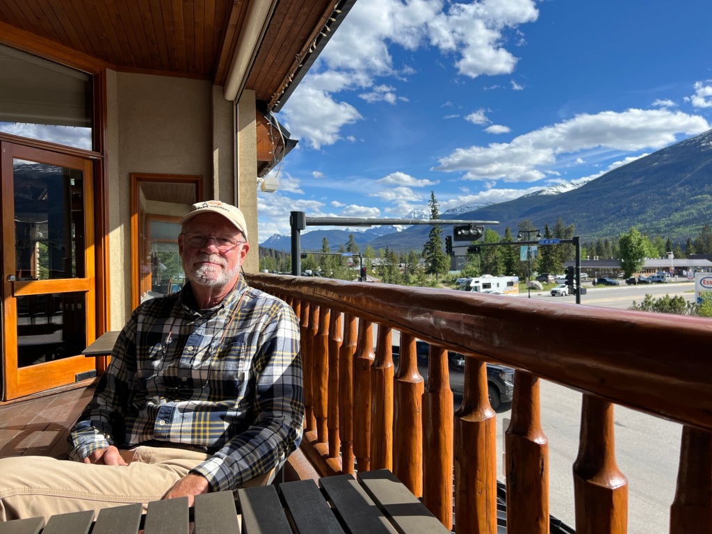
When we planned our itinerary, we figured we’d be ready to spend a couple nights in a hotel after a little more than two weeks camping so we made reservations for two nights at the Gold Rush Best Western in Whitehorse, YK.

It turns out we were right. It is the perfect time, but not just for the reasons we originally thought.

We stopped by the Teslin Tlingit Heritage Center on our way out of town this morning to learn more about the Teslin Tlingit people.

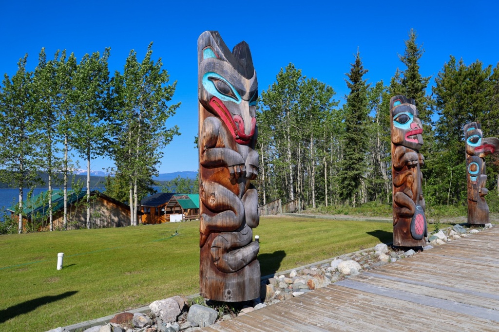
Teslin Tlingit are inland Tinglit who traveled from the southeast coast of Alaska to the interior plains of the Yukon more than 200 years ago. Until the construction of the Alaska Highway, they lived a nomadic subsistence lifestyle hunting, fishing and gathering. Hunting and gathering are still an important part of their culture.

When we arrived, a meeting of the Teslin Tlingit Council was in progress at the center. As a result, some of the exhibits and demonstrations were not available. It was actually kind of cool to be able to hear and observe the meeting as they discussed concerns and policies. Teslin Tlingit Council is a First Nations self-governing entity.

The carved wooden masks and decorative muckluks and vests sewn from animal skins and elaborate beads were amazing.

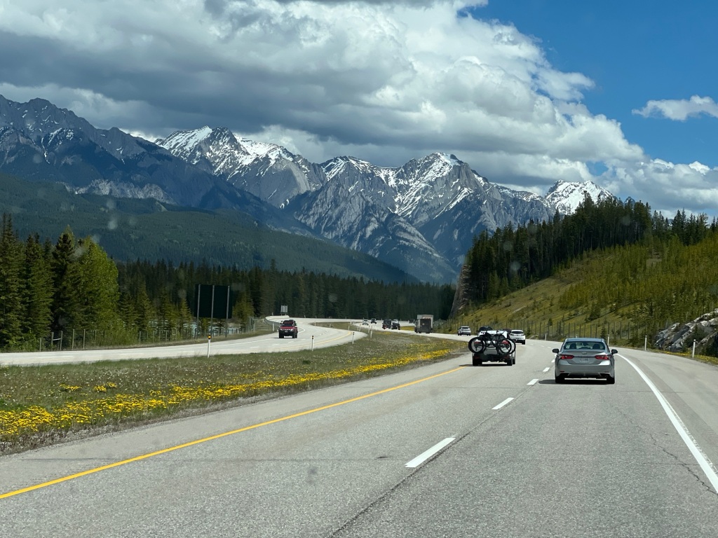
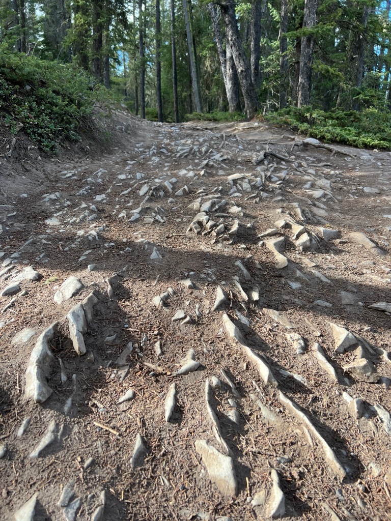
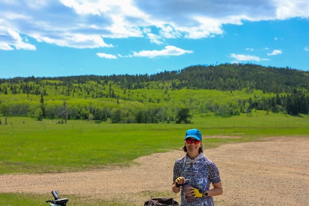
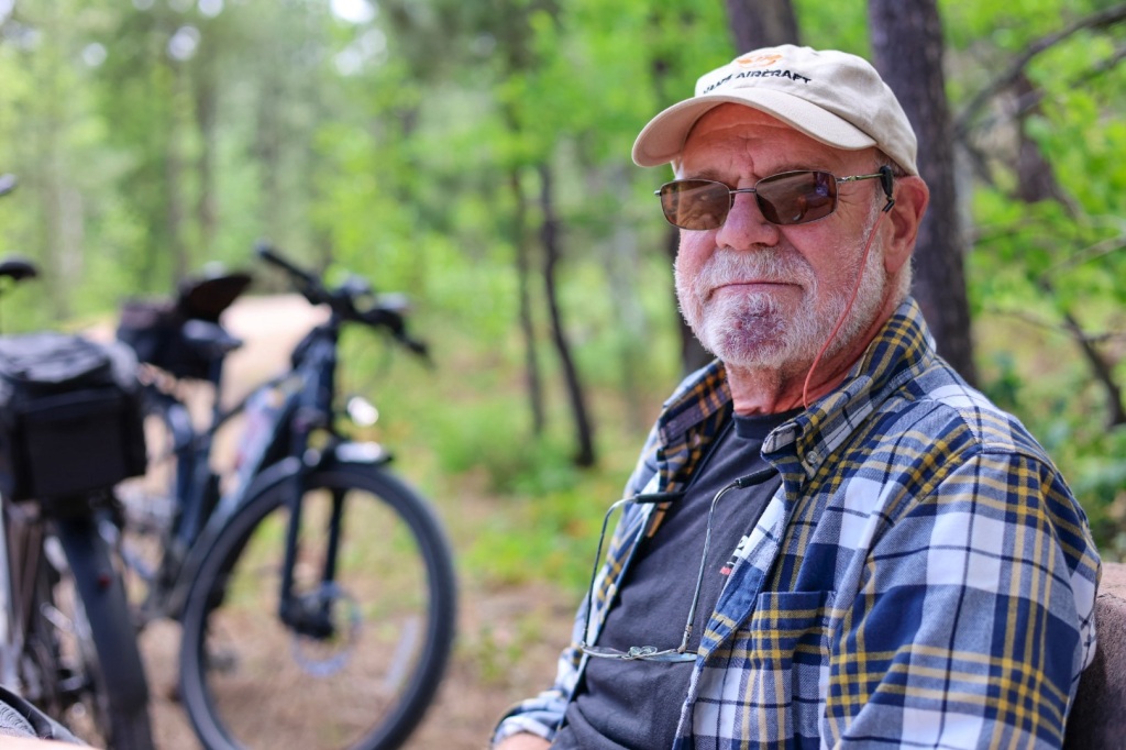
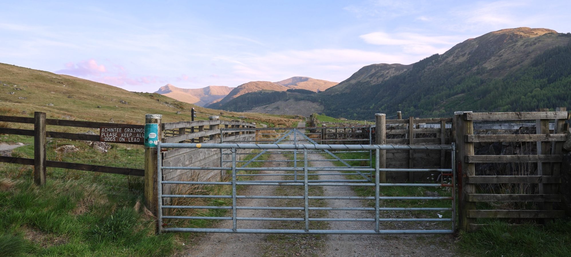
Riley is still feeling pretty fatigued so I insisted on driving the rest of the way. The weather is the warmest so far, low 80’s, so the drive was pleasant. The warmer the weather, the more bug splats though.

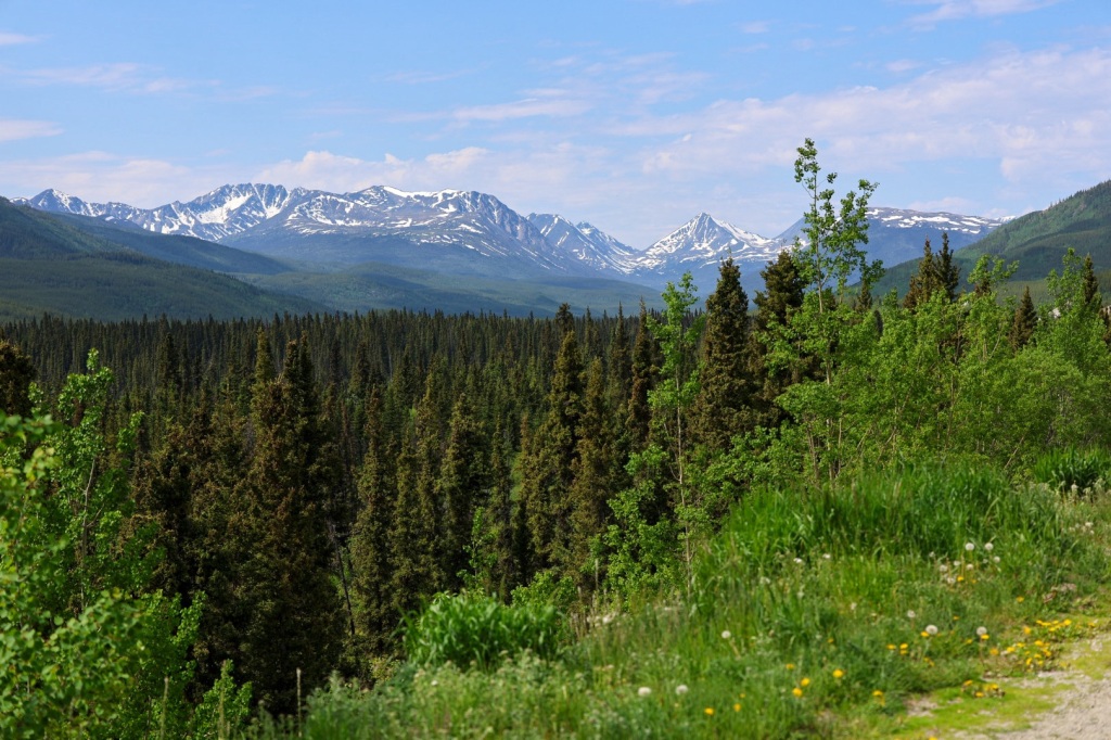
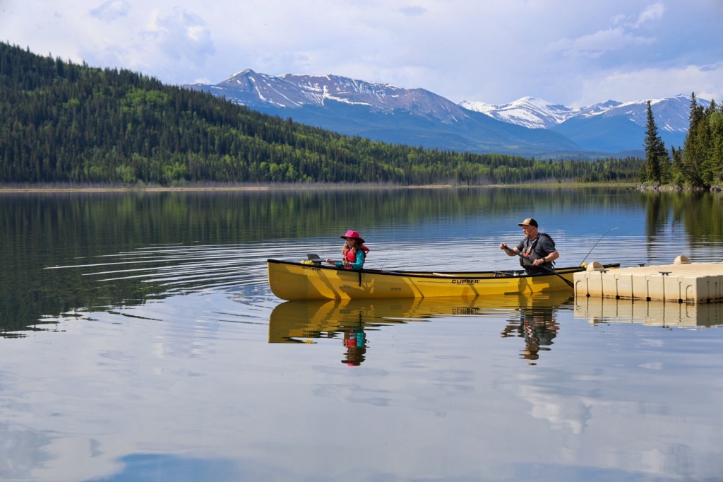
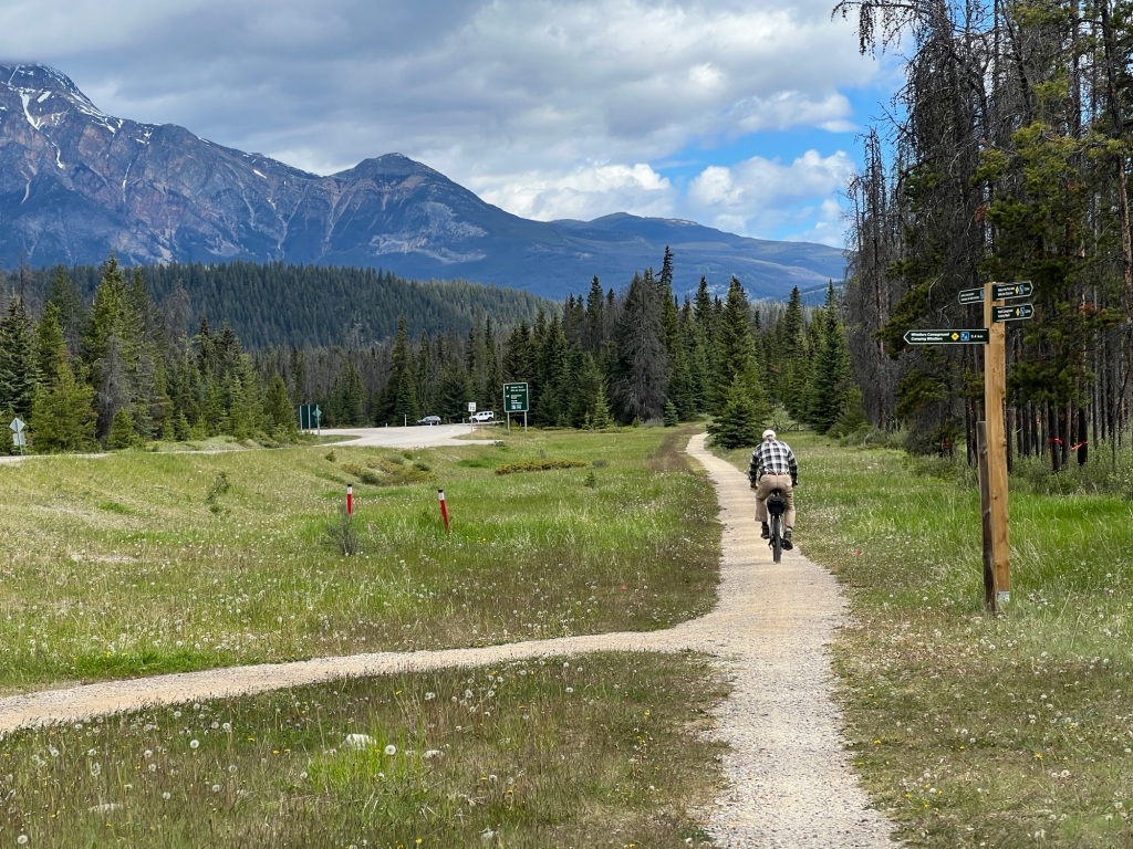
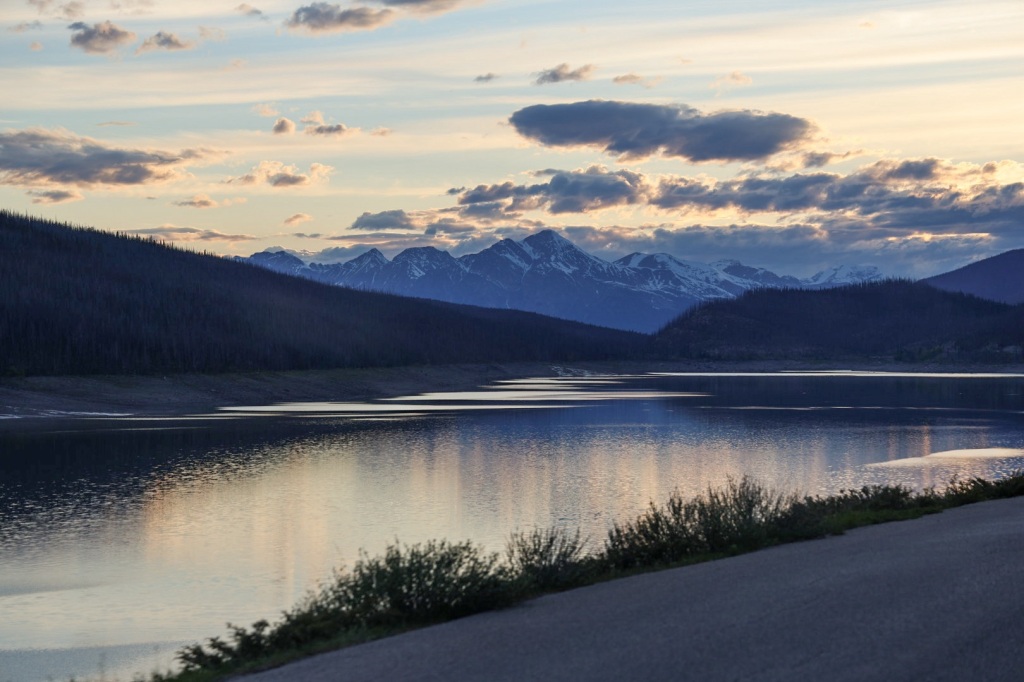
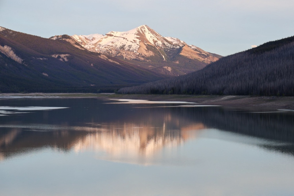
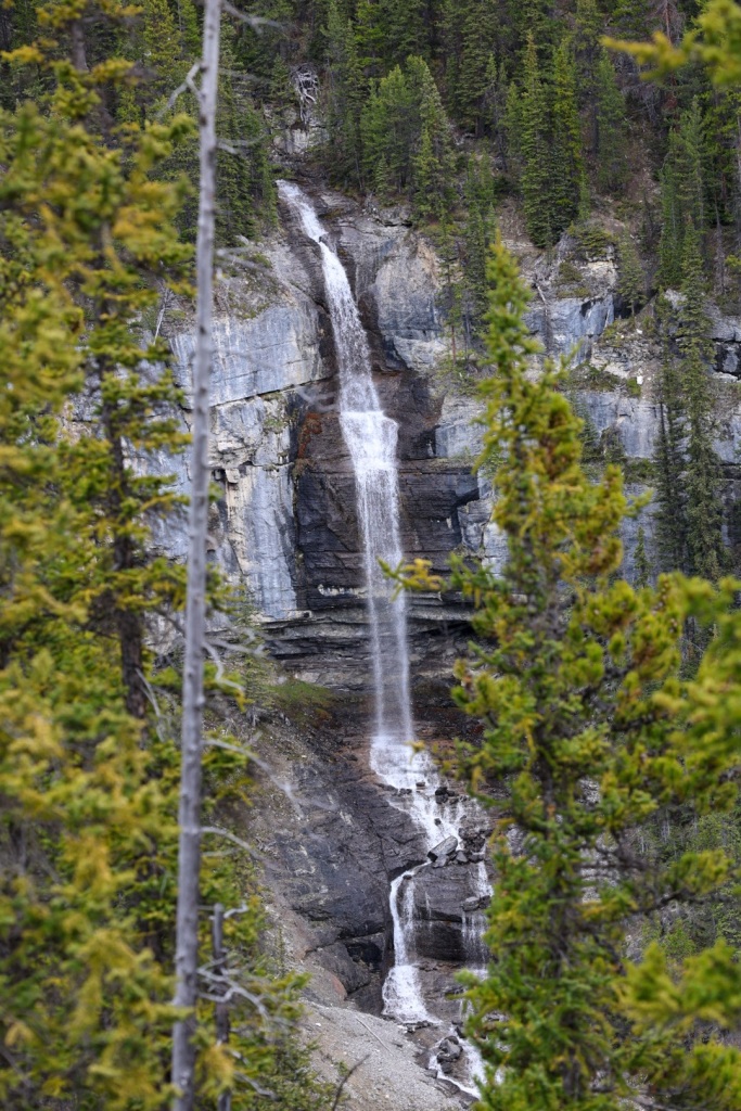
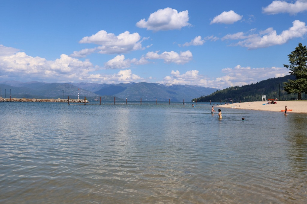
Marsh Lake is a picturesque spot to take a break. Like all of the lakes we’ve seen, the water is clear and blue.

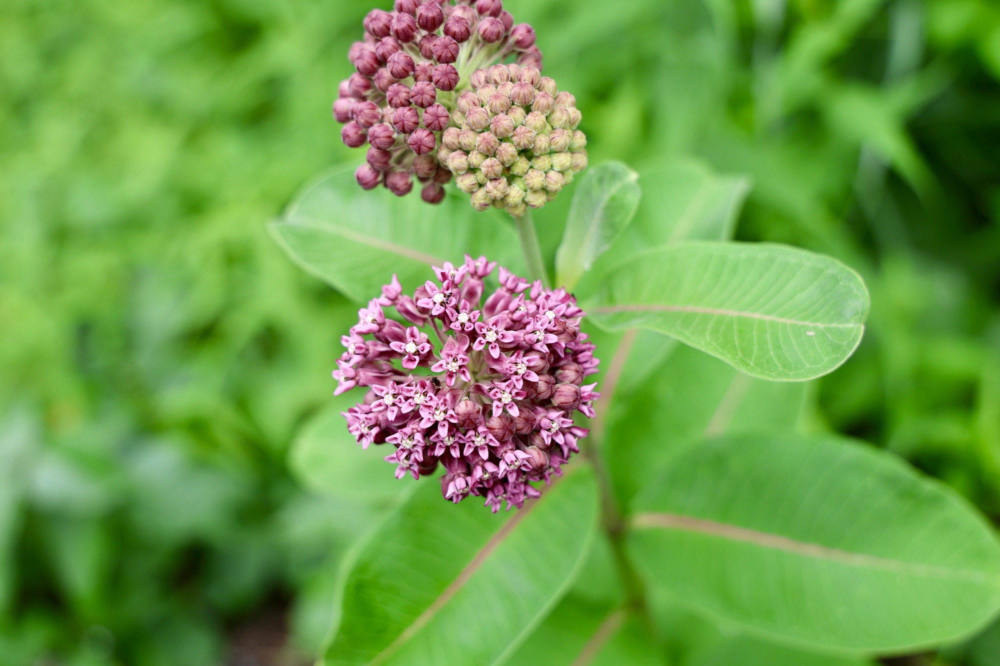
I’m not sure what attracted all the butterflies to this particular spot but they didn’t seem to mind me being close.

Just outside Whitehorse

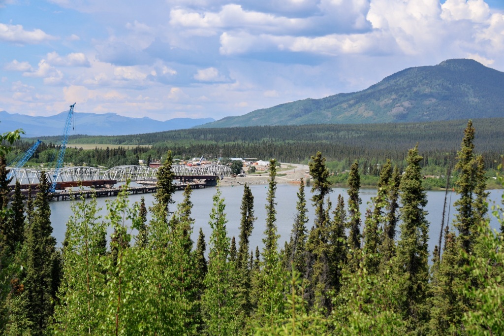
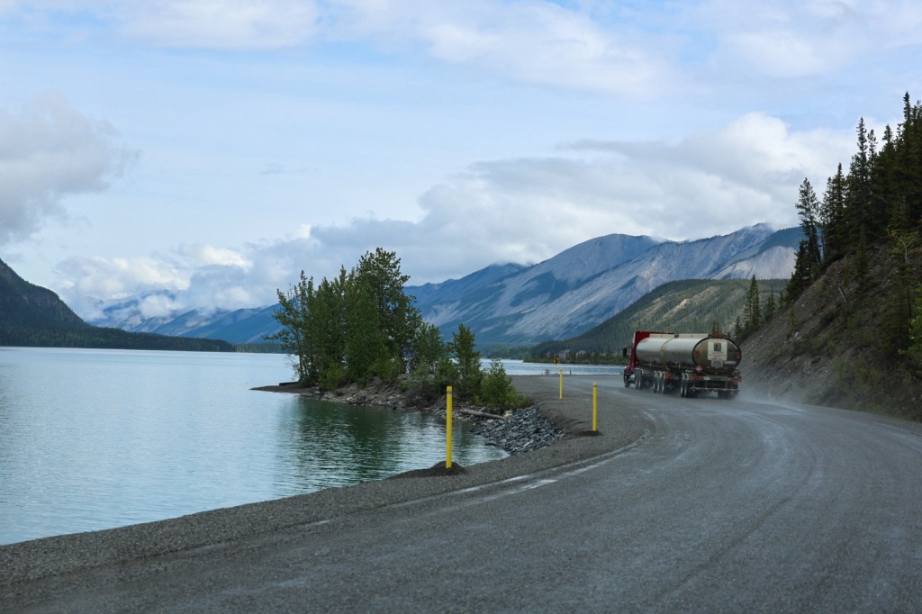
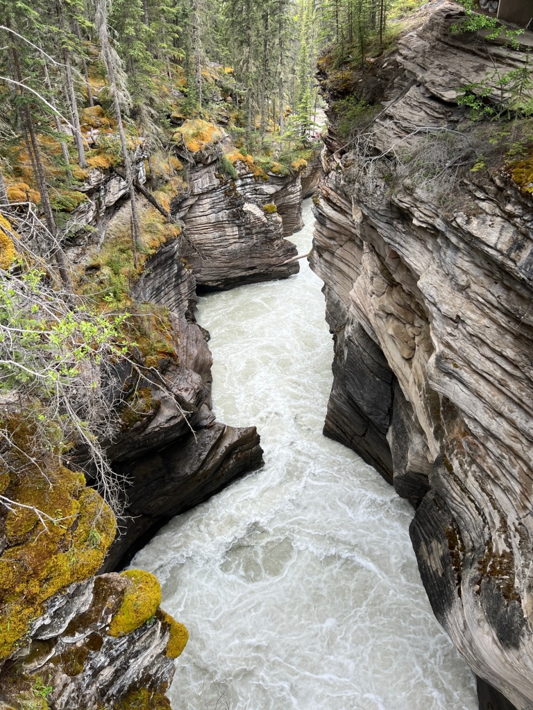
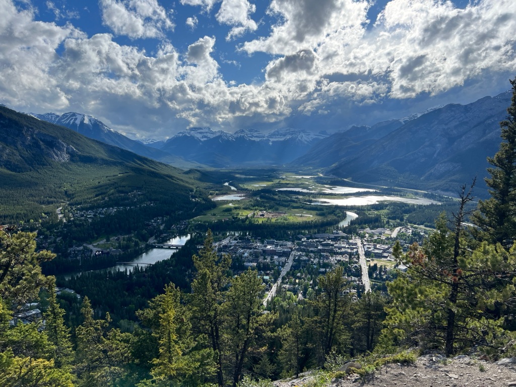
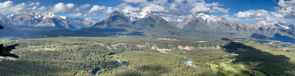
The scenic route leading into Whitehorse runs along the Yukon River. It is amazing how unnaturally green the water looks. So odd. It was really moving fast but it’s hard to see that in the picture.

Yukon River in Miles Canyon

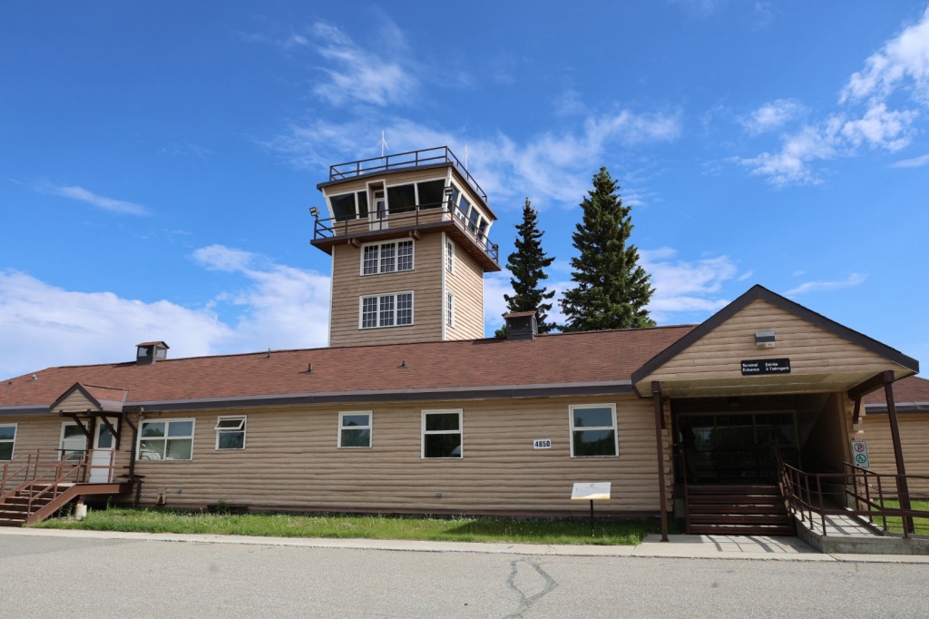
There are several charter float planes parked on the lake just outside of town. I can understand why planes are a popular transportation choice in this part of the world. It’s the only way to get to much of the territory. We’ve seem many remote airstrips along the Alaska Highway.

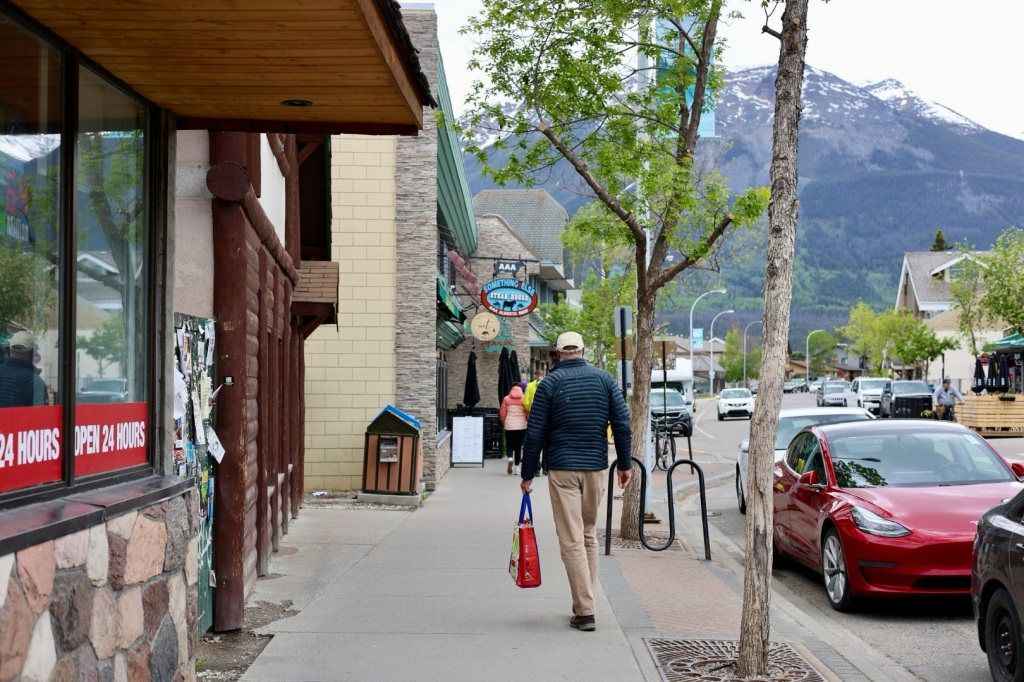
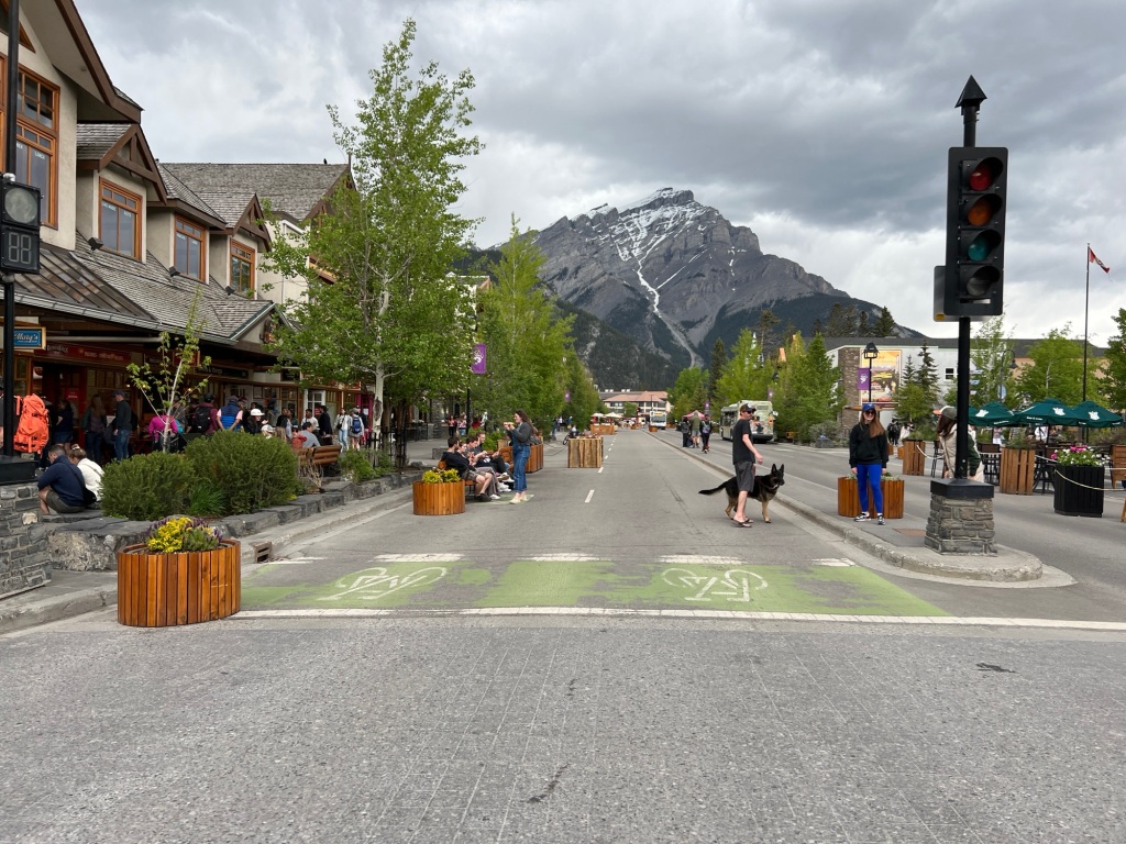
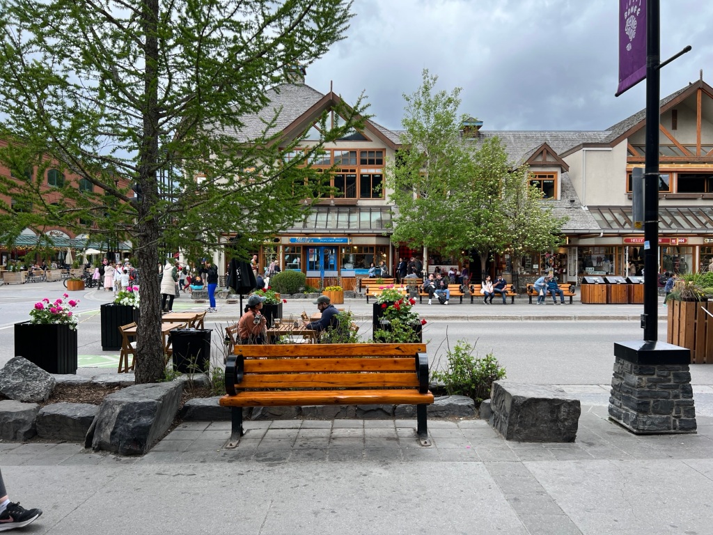
Whitehorse is very different from the tiny villages we’ve been for the last several days. It’s the capital of the Yukon Territory and practically like New York City by comparison to the places we’ve been the last week or so.

The Best Western is on Main St right in the middle of everything so it will be easy to get around. There are lots of interesting stores and restaurants to check out.

We checked in to the hotel and did some laundry. Just that small chore wore Riley out. I called my friend who’s a physician for advice. She wisely counseled Riley on the importance of staying hydrated and getting checked out by a medical professional to make sure everything is okay before we leave Whitehorse and return to the literal wilderness.

Hearing it from someone besides me helped a lot. I called the Yukon Walk-In Clinic and was told they don’t accept patients from out of the country because there’s no way to charge for their services. They suggested going to the Emergency Room at Whitehorse General Hospital.

We stopped in a pharmacy just down the street from the hotel to get some electrolyte tablets and got a bite to eat for dinner before going to the hospital.

When we arrived, I was hopeful when I saw relatively few people there. It was a different picture in the ER of course. The triage nurse said they had four major trauma patients and with a short staff it would be several hours before he could be seen. She suggested we come back in the morning.

As we walked out, Riley said he was feeling better already. Hmmmm. He does look and sound a little better, probably because he finally ate some real food and is drinking more. I’m glad that’s true but I’m still going to insist we go back in the morning.

Anybody who knows Riley will know it’s serious when I tell you he walked right to the elevator without even looking for the stairs!

Yukon Territory (4,508 miles)

This morning we are both feeling some better but definitely not back to normal. It helped that the weather is warm enough for short sleeves for the first time in days. The planned drive is only a couple hours so we’ll have plenty of time to rest and recuperate.

Watson Lake is the gateway to the Yukon, the last Canadian providence we’ll travel through on our way to Alaska. It truly is a remote wilderness.

Both British Columbia and the Yukon are covered by hundreds and hundreds of miles of boreal forests, rivers and lakes. Small villages are 100 or more kilometers between, often consisting of just a gas station. If there are fewer than 10 permanent homes, electricity is not provided so residents have to use generators for power. Bigger towns usually have a grocery store, campground, a lodge of some kind and maybe a car wash and laundromat. Often these are combined in a single business.

The Alaska Highway is the only road between towns so a GPS isn’t necessary. It would be hard to get lost. Unless you have internet connection and download the map ahead of time, you couldn’t use it anyway. Cell service disappears a few miles outside of town.

The highway was built during the Second World War to support air bases between the Yukon and Alaska. One of those is in Watson Lake so we stopped by to check it out before leaving town.

Watson Lake Airstrip is the last remaining air terminal from the Northwest Staging route still in use. Today, it’s used exclusively for private and charter flights. The main entrance was locked so we followed a sign that said to go around to the FBO. The base operator said we were welcome to look around the old terminal building and showed us the back entrance.

Old Watson Lake control tower

During the war, the Watson Lake airstrip was vital in Canadian-US efforts to defend Alaska and provide aircraft to Russia through a Lend-Lease program (which they never fully paid for). Thousands of planes stopped here for refueling and maintenance.

A collection of historical photographs are displayed in the old terminal building that describe what it was like during that time.

With the constant movement of so many aircraft around the clock, the lack of navigation aids, nasty weather and inexperienced pilots there were many accidents and crashes along the 3,500-mile ALSIB route.

There were communication problems because of a shortage of Russian-English interpreters, and freezing temperatures made routine chores extremely difficult. Mechanics learned that working for five-minutes without gloves would cost them some fingers.

A significant cause of death was pilot disorientation in freak weather conditions, which resulted in mid-air collisions and crashes. At least 140 Soviet airmen died on the ALSIB route between Fairbanks and Krasnoyarsk.

Hangar

Pilots had no heat in the cockpit, other than what a plane’s engines generated. Windshields froze over and instruments often became unreliable. In sub-zero temperatures motor oil turns to molasses, rubber becomes brittle and cracks, and rivets fall out of their holes. In a few short minutes a solid, well-made airpcraft could become a rattling and drafty collection of loose parts at 22,000 feet.

Crash landing on the lake

It wasn’t only men. Many of the pilots who ferried Lend-Lease aircraft along the Northwest Staging Route were women flying B-17s. Women Auxiliary Service Pilots (WASPs) were used to free men for combat roles during the war.

After leaving the airport, we started our drive north. The landscape was beautiful with snow capped mountains over miles and miles of forest.

We were surprised that the campground we’d just stayed at didn’t have bear-proof trash cans like we’d seen everywhere else. We guessed they must not have a problem with bears, then we saw this guy lumbering across the road not too far from town.

We stopped to stretch our legs at Rancheria Falls. It was just a short walk through the woods and along a raised boardwalk to an overlook of the falls. So pretty!

Tonight we’re staying at the Yukon Motel campground in the Village of Teslin. The campground is on Teslin Lake, just beyond the bridge you see in the photograph.

Not a lot of scenery at this campground

I was surprised by the number of cyclists we saw riding on the shoulder of the highway between Teslin and Watson Lake. I can’t imagine how painful it would be to be hit by a piece of gravel considering the damage it does to a windshield.

We’re planning to visit the Tlingit Heritage Center tomorrow before we drive up to Whitehorse. For now, we’ll rest and relax in hopes of getting back to normal.

Muncho Lake and Watson Lake (4,318 miles)

I don’t feel much like writing today so this will be shorter than usual. I knew I was getting Riley’s cold when I woke up yesterday morning and we’ve both been pretty miserable since.

Even though neither of us felt like driving, we left Tetsa River and drove a couple hours to Muncho Lake where we’d planned to spend the night. The weather was cold and rainy when we left but as typical for here the sun soon came out making it a beautiful day.

Muncho Lake is a beautiful spot and the highway runs right along the shore.

We didn’t have reservations anywhere so when I saw the advertisement for Northern Rockies Lodge I knew that’s where we should stop. I hoped we would be able to get a room in the lodge but none were available. It was still early when we got there so I asked the receptionist to let us know if they have a cancellation.

The campground was also full, but there were two spots reserved for the pilots of the float planes docked on the lake. After a phone call to make sure it was ok, we took one of them right beside the lake.

The spot was beautiful but we were both feverish and exhausted. We pulled out the bed and slept until the afternoon. Soon after, the receptionist knocked on the door and said they have a cabin available if we wanted it. YES we do!

The cabin has 3 beds and a bathroom which is exactly what we needed. We slept the rest of the day and night and woke up feeling pretty much the same.

We’d planned to go to Liard Hot Springs Provincial Park where we have reservations for the night but hot springs and fevers don’t really go together so we soldiered on to Watson Lake. On the way we saw a herd of buffalo and some mountain goats. Oh, and we got another rock to the windshield by a passing truck. I think we’ll be experts at windshield repairs when this trip is over.

Riley was feeling some better by the afternoon, thank goodness. We’re staying at Downtown RV Park, just a block from the famous Watson Lake Sign Post Forest.

The tradition of hanging a sign in this particular spot began in 1942 when a homesick soldier working on the construction of the Alaska Highway hung a sign with the name of his hometown. Today, there are over 100,000 signs affixed to every available post, tree and hard surface.

We walked over to The Northern Lights center across the street to watch an interesting movie in a big planetarium theater. Now, I think we’ll watch a little television and go to bed (again).

The Alaska Highway (4,066 miles)

On our last morning in Jasper we had breakfast at a restaurant downtown and had the most delicious avocado toast and eggs I think I’ve ever had.

Back on the road again

As we traveled north, we left the Rockies behind and the landscape flattened out to green pastures and farmland.

The weather was nice and mostly sunny for the morning drive. Looking to make a mid morning pit stop, we stumbled upon one of the most picturesque spots around.

Grand Cache Lake is crystal clear and the backdrop of evergreens and snow capped mountains was stunning. I was admiring the view just as a man and his daughter were launching their canoe for a morning paddle. They had this gorgeous place all to themselves.

Riley woke up that morning feeling like he might be coming down with a something and by midday he was certain of it. We were prepared for headaches and general aches and pains but didn’t have any cold medicine. A quick stop at a pharmacy in Grand Prairie took care of that.

Traffic was pretty light so we made good time. The mostly two lane highway passed through several small towns and communities but Beaverlodge was one of the most memorable.

From there we continued west to Dawson Creek, BC where we had reservations at the Northern Lights RV Campground hosted by two very friendly but very loud, talkative ladies. We were both relieved to get out of the small office where the two of them were having simultaneous conversations with guests checking in.

The campground is basically a large gravel parking lot with just-big-enough-spaces for an RV. There were water and electricity hook ups and room for a picnic table but little else.

Rather than using the laundry at the campsite, we drove a short distance to town. We popped into a laundromat, started a couple loads of laundry and walked up the street for an early dinner at Post and Row Taphouse. Charlie was looking pretty dirty so we stopped by a car wash before going back to camp.

The weather has been partly cloudy with temps in the upper 50s to low 60s most of the day. By evening it began to rain and a cold wind kept us inside. Riley was feeling pretty tired and a bit feverish so he took some NyQuil and napped while I caught up on the latest season of Bridgerton on Netflix.

In the morning, Riley was still feeling pretty crappy. I drove so he could rest and hopefully start to feel better.

The Alaska Highway begins in Dawson Creek, BC and stretches 1,382 miles across the Yukon and all the way to Delta Junction, Alaska. We’ll drive on this road the rest of the way to Alaska.

Before we left on this trip, we bought several publications recommended by others who have made the trip before. Everyone agrees The Milepost is the one book you must have. It’s 656 pages chronicle every detail of the Alaska Highway with mile-by-mile descriptions of all major highways and roads in Alaska and Western Canada; detailed information on all cities, communities, national parks, attractions, grocery stores, fuel stops, campgrounds, restaurants, services, road conditions, etc.

Of course, we also have our trusty Rand McNally Road Atlas and fold-out paper maps of Alaska and the Yukon. We’ve already seen the you can’t rely on internet or cellular service so it’s best to have paper maps.

As we travel north, we’re seeing snow-capped mountains in the distance again and also seeing more and more wildlife. So far we’ve counted seven black bears, one fox, two mule deer, lots of elk, one having huge antlers, and six buffalo. All while driving down the highway.

Today, I noticed a yellow warning sign along the highway with a picture of a buffalo so I made sure to watch the road carefully. Sure enough, just a few miles down the road these guys were standing in and beside the road! I pulled over so Riley could take some photos from a distance. Fortunately they didn’t seem to mind.

Earlier on the drive, I’d been following a tanker truck for several miles. Another truck and an RV whose driver obviously wasn’t using cruise control was in front of it.The RV kept speeding up and then slowing down at every hill and curve in the road, making it hard to keep a consistent distance behind the tanker. During one of those slow downs, a rock flew up from the tanker and dinged the windshield leaving a small bulls eye crack. Perfect.

I cussed under my breath until all three miraculously stopped for gas at the same time. I breathed a sigh of relief, resumed cruise control and enjoyed the view.

We had one more oh, crap! moment today when we thought we might run out of gas. We’d passed a gas station with a little under a half tank and thought about stopping but we felt certain that we’d pass another station before we really needed fuel. When we were down to a quarter tank, I checked the estimated range and it said we could go another 111 miles. Riley looked at the map in The Milepost and the next one he saw was 132 miles away. Uh oh!

We stopped to reassess the situation and decide if we should turn around. Riley looked closer and realized that all the gas stations aren’t indicated on the map. The mile-by-mile description said fuel is available at the Tetsa River Lodge, about 12 miles ahead. Thank goodness! From now on we’re going to fill up when it’s a half empty.

This is the first night we don’t already have reservations at a campground so we need to find a place to stay the night. As luck would have it, Tetsa River Loge also has an RV park with space available for the night. Riley is still feeling pretty bad so we decided this would be a good place to stop for the night.

Our campsite is nice other than a little muddy. The tree cover blocked the StarLink from tracking satellites so we did without internet or cell service the rest of the day.

Fancy shower house haha

We’d anticipated windshield damage and got a repair kit from Amazon before we left on the trip. We dug the repair kit out and read the instructions. The epoxy or whatever it is that fills the crack in the glass needs ultraviolet light to cure and the only ultraviolet light available is the sun. Unfortunately it’s behind a thick layer of clouds. It looks like the repair won’t be complete until the sun shines again.

I’m a little concerned about Riley. The medicine is helping with symptoms but he’s not getting any better. I hope a good nights sleep will help and that feels much better in the morning.

The camp host serves fresh baked, “world famous” cinnamon buns for breakfast every morning. Maybe that and a big glass of cold milk will do the trick. Otherwise, we might need to consider driving on through to the next larger town.

R&R in Jasper, AB

Jasper has become one of my favorite places. It’s beautiful, has great restaurants, shopping, convenient bike paths, hiking trails and camping. It has all the amenities of a tourist town without feeling like one. I’m sure it’s bustling in summer but right now it’s perfect. We are both ready to spend a couple days in one place after traveling for the last 10 days and this is the perfect place to do it.

I also have an affinity for Canadian culture. There a general feeling of peace rather than division, diversity is embraced rather than discouraged and people seem more respectful of each other. I also appreciate the environmental mindset. There are as many recycling receptacles as waste cans. So many reasons to love it.

Bike path to town

After breakfast, Riley and I rode about 3 miles on the bike path that connects the campground with downtown Jasper. It’s so convenient to have a dedicated trail instead of sharing the road with other traffic. We spent the morning shopping and walking around town. There are several nice outdoor clothing stores, some upscale specialty shops and the expected t-shirt and souvenir stores. Shopping wouldn’t be complete without a stop at Bear Claw Bakery for a sticky bun and (of course) a big glass of cold milk.

Later, we went back to camp to relax and plan how to spend the rest of the day. There are lots of hiking options in the Maligne Valley just a short drive away. Riley looked up details on the AllTrails app and we decided on the Maligne Canyon loop to Sixth Bridge, a 5-mile hike along a deep gorge with several footbridges that cross the river.

We opted to wait until evening to avoid the crowds. Parking is limited and Charlie takes up a lot of space so we didn’t want to risk driving all the way out there and have nowhere to park. This time of year days are really long so daylight won’t be a problem. The sun won’t set today until around 10:15 PM.

After a nice dinner in town, we drove to the trailhead. Other hikers recommended hiking in a counterclockwise direction to save the best for last. That sounded like good advice, so we set out around 6:45 PM for the 2 hour hike.

The trail was hard packed and dusty but you could see that it’s really mucky when it’s wet. There were lots of foot-sized depressions in several long stretches where people have slogged through the mud. I’m glad the sun’s been shining all day and everything is very dry.

The trail wound through the woods and gradually descended to follow the river. The last bit was pretty steep with loose gravel and a thick layer of loose, powdery, dirt. I was glad we wouldn’t return on the same path.

Sixth bridge, the first we encountered, spans a wide section of the river. The aqua colored water is so clear you can see the rocks and sand on the bottom even in the deepest water.

A large elk was standing on the far end of the bridge and two more standing on the opposite river bank not far from a family sitting down for dinner at a picnic table nearby.

We watched and waited until they wandered into the woods down river. They were the only wildlife we’d seen so far, but we’d been keeping an eye out expecting it, especially this time of evening. Riley was carrying bear spray just in case.

The view from Fifth bridge didn’t quite live up to the hype we’d read about and I began to doubt this hike was such a great choice. While nice, it didn’t seem particularly impressive.

It wasn’t until a bit further up the trail that I looked back and realized the view of Fifth bridge is what they were talking about. The river flowing under the bridge with snow capped mountains in the background was just beautiful. Photographs don’t do it justice.

The views became increasingly more dramatic the further up the canyon we climbed. Water from Maligne Lake and Medicine Lake feed the river rushing through the narrow canyon. As the canyon narrowed, the volume of water per second increased. You could almost feel the roar of the water, especially standing on the bridges and overlooks.

The winding, twisty canyon walls are more than 50’ high. Rounded, carved out sections in the walls are created by rocks and sand carried by the rushing water. These potholes are aptly named.

We saw boulders suspended high up between the canyon walls. Erosion will eventually cause the chock rocks to crash into the river below. Dead trees that have fallen into the river collect in narrow spots creating choke points but the water still finds a way.

Evening was definitely the right choice for this hike. We encountered just three groups of people on the entire trail. A father and his young son walked the last bit with us. It was heartwarming to observe them as we examined fossil remains in a stone alongside the river. The boy was excited when he realized he was seeing the remains of a gastropod from 366 million years ago.

With an hour of daylight left, we thought we might have time to drive to Maligne Lake in time for sunset. The drive was longer than we expected, partly due to the increased likelihood of animals in the roadway that time of day. We drove past Medicine Lake but turned around shortly afterward to make our way back to camp.

Medicine Lake at sunset

It was after midnight by the time we showered and watched an episode of Foyle’s War (thanks for the DVDs Paige!). That’s the latest we’ve stayed up so far. I’m sure we’ll have later and later bedtimes as we travel north. It’s only one week until Summer Solstice!

Tomorrow we’ll be back on the road headed to Dawson Creek, BC.

Lake Louise, Icefields Parkway and Jasper National Park (3,301 miles)

I’ve wanted to go to Jasper, Alberta since I was a young girl listening to John Denver sing about it. I could almost see a meadow with two men and four ponies on a long, lonesome ride. ~Rocky Mountain Suite

At the time, I hadn’t traveled far from NC and could only imagine how amazing the Canadian Rocky Mountains must be and knew one day I wanted to see it in person.

Today that dream came true and it was even more beautiful than I imagined.

Just amazing

From Banff, we drove north to the Ski Louise Resort at Lake Louise to ride the summer gondola to the top of the mountain. I was glad we’d purchased tickets in advance when I saw hundreds of vehicles already there when we arrived around 9:30 am. Inside the lodge there were lots of people getting coffee and milling around. We followed the signs downstairs and outside to the gondola and were surprised to see on one in line or in the gondolas and chair lifts slowing climbing up the mountain. At first we thought we must not be in the right place, but we walked down and the attendant greeted us and ushered us to an open car.

The ride up was great! The views of Lake Louise surrounded by mountains was spectacular. The one thing we didn’t see were many other riders.

At the top, Riley asked the attendant where all the people are. She laughed and said, all the other cars are for the Park and Ride into town. Oh, now it makes sense.

There was only one short trail at the top so we walked around and marveled at the view for a while before heading back down, this time in an open chairlift. It was a little chilly, but that’s what jackets are for.

I think Riley would’ve preferred riding down in the gondola

Icefields Parkway is one of the most scenic drives in the world. The 140 mile road winds through the heart of the Canadian Rocky Mountains from Lake Louise to Jasper. We were amazed by stunning views of glaciers, lakes, waterfalls and wildlife during the entire 3’ish hour drive.

Athabasca Falls was one of the most beautiful places we stopped to hike. The 23 m falls are fed by the Columbia Icefield and wind down though a gorgeous canyon carved by the Athabasca River.

We gotten a good start on wildlife sightings. The tally so far includes four more black bears, numerous Columbia Ground Squirrels, a handful of goats shedding their winter coats and several elk, one crossing the highway in front of us as we drove into Jasper.

It’s elk calving season so rangers at both Banff and Jasper National National Parks warned to be especially wary of elk wandering around the campground. In Jasper, elk have caused more serious harm and injuries to people than any other wildlife.

Bridal Veil Falls was just one of many waterfalls visible from the road. There aren’t enough hours in the day to see everything.

Jasper Brewing Co sounded like a great place for a late lunch, early dinner before setting up camp in the Wapiti campground in Jasper National Park. The food and the beer were good!

I was happy to see that the campground is in the woods like you’d expect. It would’ve been disappointing to have another spot like we had in Banff.

The other unexpected perk is free firewood! Many campgrounds charge ridiculous prices for bundles of firewood that more often than not are too green or wet to actually burn. Not the case here ! Wood is dry and plentiful.

Look at all that wood!

Riley toted several armloads of wood to our site and split it so we can have a nice fire for relaxing in the evening .

We’ll be here for two nights so our plan for tomorrow is to explore the town and find a good day hike.

Canadian Rockies (Banff, bears and beautiful views 3,117 miles )

After a short drive to the Canadian border crossing , we left Idaho behind and began the most exciting part of our journey.

The checkpoint was quick and easy. We’d read stories from other travelers of having their RVs searched by border agents so we were prepared for the same. The officer was very friendly and asked only if we had excessive amounts of alcohol or cigarettes, any firearms or ammunition, where we were going, how long we’d be in Canada and why we’d chosen this route since we live on the East Coast. That was it.

First look at the Canadian Rockies

The drive over the next few days will take us through the Canadian Rockies with the first night at Tunnel Mountain Village II in Banff National Park.

We arrived in Banff in the early afternoon and stopped downtown to check it out before going to the campground. It’s a cute town, but super touristy and crowded. I can’t imagine how it must be in the middle of high season.

We found on street parking without too much trouble and walked over to a nearby bakery. Well, actually we went to two different bakeries. The first had fresh bread but the pastry case was nearly empty, as any decent bakery should be this time of day. Fortunately there was another around the corner with one last cinnamon roll just for Riley.

Tunnel Village campground is one of the oddest places we’ve stayed. The sites are basically parallel parking spaces on either side of the roads running through the campground. A picnic table and water and electric hookups are in the grass beside the road. So odd.

But, you can’t complain about the view!

You can see other campers lined up and down the road

The weather on the drive in was mostly rainy and cool. I wore jeans for the first time this trip and pulled our jackets out of the closet. We felt lucky that it cleared up about the time we arrived in Banff but it wasn’t long before we realized just how quickly the weather changes here. It literally would be sunny and almost feel like summer one minute and dark skies, cold wind, lightening and rain/sleet/hail the next. Then sunny bluebird skies would return moments later.

My WeatherBug app said no rain was expected for the next couple hours so around 5:30 or so we hopped on our bikes and rode back to town to hike the Tunnel Mountain trail. The trail is about a 3 mile round trip to the summit of Tunnel Mountain, with great views of Banff and surrounding area.

There were as many trail runners as hikers, running up and down past us on the rocky trail. I’m sure it’s a standard route for local runners. One fellow passed us three times, twice going up and one going down. Riley said the only way he’d run that trail is while wearing a RedMan suit. If you’re like me and don’t know what that is, look it up. I’m betting if he had one he still wouldn’t run up or down the trail. Haha.

Tunnel Mountain was named by the railroad when they were mapping out the route through the Rockies because they thought they’d need to tunnel through it. Ultimately they decided to go around it instead but the name stuck.

View of Banff
View from the opposite side

The sky darkened and thunder rumbled as we rode back to camp. It cleared up again in time for Riley to grill turkey burgers for dinner. He was doubtful when I suggested ground turkey instead of beef but even he agreed these were some of the best burgers we’ve had.

Storm clouds gathering again

Another storm blew through at about 9:30 and the rain and howling winds drove all the campers inside their RVs for the night. Up until then, there had been a handful of hardy campers sitting out at their fire pits bundled up in down jackets and beanies looking like they were cold in spite of the fire.

It wasn’t that the temps were super low, probably around 50 degrees, but the wind was definitely chilly. It did get down into the 30’s overnight though. Our furnace came on for the first time this trip. I hope we don’t need it for long but I’m betting it will be awhile before we’re wearing shorts again.

Our first wildlife sighting happened on the drive into Banff. A smallish black bear was walking in the woods beside the road. This morning there were four of five elk grazing in the grass between the picnic tables beside Charlie. I’m hoping we’ll see a lot more!

Pacific Northwest (2,846 miles)

This is the last day of travel in the US before we cross into Canada. Since eggs are on the list of prohibited items you can bring into the country, we made French toast for breakfast. It’s a sacrifice, but you do what you gotta do. Haha.

It was my turn to drive again so we switched places after getting fuel and refilling the DEF tank. I’m glad Riley knows all about that stuff and remembers to take care of it. I’d have a lot to learn if I were doing this on my own.

The route across Montana to Coeur d’Alene, Idaho traversed several mountain ranges and National Forests. The landscape changed again, now dominated by dense, towering pines.

We chose to stick to the interstate because it was the quickest and most direct route to Coeur d’Alene. Usually that means monotonous driving with only exit signs and mile markers ticking off the miles. This was much different. White pines, fir, spruce, cedar and many other varieties of evergreen trees as far as you can see. So beautiful.

Coeur d’Alene is a satellite city of Spokane, WA and has a definite big city feel in contrast to the remote mountain passes we’d just driven through. It’s a popular tourist destination with golf courses, a casino resort, restaurants and a super fancy RV park right on the lake in the center of town.

We drove past the yachts docked on the lake shore and took our place in the long line of RVs waiting to check in at Blackwell Island RV Resort. Riley walked to the office to check in while I waited in line. After a few minutes he came out and said they had no record of our reservation. I pulled out the folder of confirmations we’d printed out and flipped through the pages to June 10th. What the heck?! They were right. Our reservation is for a campground and hour and a half up the road. Doh!

Neither of us remembered why we’d changed plans, but we obviously had. Unfortunately I hadn’t updated the Alaska Roadtrip note on my iPhone that we use to navigate driving directions each day.

That was embarrassing. But, I wasn’t really disappointed that we wouldn’t be staying in the bustling campground. It was beautiful, but it had a hoity-toity resort vibe that clashed with our experience so far.

The upside to driving another hundred miles today is we’ll be closer to the Canadian border. It would’ve been a real bummer if we had to backtrack.

We stopped in the picturesque town of Sandpoint, ID for a late lunch at the Burger Dock. Lots of people were out enjoying the water, paddle boarding and swimming at the beach. It looks like a great place to spend a few days.

We crossed the Moyie River bridge just before getting to the campground. It’s an impressive 1,223 feet long and 464 feet high.

Bridge over Moyie River Canyon
The Moyie River power dam in the distance has a 212 ft drop

Hemlocks Lodging and RV park couldn’t be more different from Blackwell Island. It’s a small campground tucked in the trees right off Highway 2 in the tiny town of Moyie Springs, ID. The office was unoccupied so we went ahead to our site and set up camp. Campsites are tucked into the hemlock trees, giving the feeling of camping in the woods.

There’s a small roadside-motel looking lodge on the property as well. From what I saw, I’m guessing it’s a home away from home for men working in the area. Everyone was very nice, especially the fellow who gave me the phone number of the campground owner so I could call and get the code for the keypad on the bathhouse/ laundry room. I’ve seen worse showers, but it’s been awhile. Haha

We built the first campfire of the trip with wood and branches scattered nearby. The fire ring is right on the edge of the woods so Riley filled a bucket with water, just in case.

This morning we saw a big white rabbit and a couple buff colored ones in the woods right behind Charlie. Later Riley saw another beside the door. Maybe they’re somebody’s pets?

I’ll bet you wouldn’t see that at Blackwell Island.

The Black Hills of South Dakota

It’s been six days since we left North Carolina and travelled 2,099 miles across the Midwest. Today reminds me how much I love the landscape of South Dakota and Wyoming. Wide open skies and rolling green hills as far as you can see. Pictures just cannot convey the depth and breadth of what I see with my eyes.

We’d seen billboards advertising Wall Drug Store for more than 256 miles traveling on I-90 W so naturally, we had to stop when we finally drove through Wall, SD just outside the Badlands. If you’ve ever been to South of the Border on I-95 in South Carolina you have a good idea what it’s like. Just imagine 76,000 sq feet of cowboy Wild West themed clothing, boots, artwork, activities, dining and souvenirs.

As tempting as I know all this sounds, we managed to leave without buying anything other than some donuts and a cinnamon roll.

The backstory is kind of interesting. Dorothy and Ted Hustead bought the only drugstore in Wall, SD in 1931. Five years later the business hadn’t grown much. On a sweltering July day, Dorothy had the great idea to put signs out on the highway advertising FREE ICE WATER to passing motorists. The rest is history. The billboard advertising campaign continues almost 100 years later. The farthest sign is a 394-mile drive away, 300 signs in total. Well, I guess if you find something that works, stick with it!

Looking at the day’s driving route to Sheridan, Wyoming, I realized another rails to trails bike trail I’ve heard about is just a short detour off the interstate. The George S. Mickelson Trail in the Black Hills of South Dakota is listed on the Rails to Trails Conservancy Hall of Fame. After riding a portion of it I can understand why. It’s gorgeous.

The 109-mile trail was once part of the Burlington Northern Railroad. The gravel trail runs through scenic, mountainous, Black Hills National Forest. We rode a 24-mile out and back from the Kirk Trailhead south of Lead, SD to the Dumont Trailhead north of Rochford.

The trail was partly shaded by the ponderosa pines, aspen, birch, oak and spruce trees that make up the forest. I’d love to see it in the fall when the aspens turn gold. A cool breeze helped temper the heat from the sunshine and the exertion from pedaling our bikes.

We stopped for a picnic lunch at a bench beside the trail near a marker pointing out a mine situated on top of the mountain in the distance. We’d noticed it on the drive in and wondered what kind of mine it was. The Homestake Mine in Lead, SD was a gold mine until it closed in 2002. According to Wikipedia, it was the largest and deepest (8,000 feet) gold mine in the Western Hemisphere, producing more than 43,900,000 oz of gold during its lifetime. That’s equivalent to 2,500 cubic feet of gold!

Homestake Mine

Since 2007, the Homestake Mine has been the location for the National Science Foundation’s Deep Underground Science and Engineering Laboratory (DUSEL). That’s not the first time the mine has been used for scientific purposes.

The Homestake Mine is famous in scientific circles because of the work of a deep underground laboratory that was established there in the mid-1960s. This was the site where the solar neutrino problem was first discovered, in what is known as the Homestake Experiment

A Park Ranger checking park passes waved for us to stop as we passed through the Englewood Trailhead. We‘d seen the self-pay registration kiosk where we’d parked, only because we were looking for the trail map. The fee is $4.00 per person, cash only. Having exactly four dollar bills and a few $20’s, we folded up the dollar bills, sealed it in the envelope and figured that was close enough as we dropped it in the slot. Instead of carrying the customer copy of the single permit with us, we left it in Charlie. Uh,oh. Busted!

I told the ranger we’d thought the permit was supposed to be on the vehicle (leaving out the part that we’d only paid for one person). She looked at me like I was either lying or an idiot and explained that the permit clearly says “Keep it with you while on the trail, as pass must be offered for inspection when requested.” Pointing to a man sitting in a truck a few yards away, she said “I’ll let you go with a friendly reminder, but he’s the CO and wouldn’t be so forgiving.” We rode on, thankful we didn’t get pressed further.

I was feeling guilty as we rode the remaining miles to Dumont Trailhead and hoped there would be someone there who could break a $20 for us and we’d just pay for two new passes and everything would be squared away. But…. no luck. Also, who carries cash anymore anyway?

Dumont Trailhead

I looked online to see how much the fine for riding without a permit would be when I saw an option to buy permits online. Great! Following the link, I discovered the only Mickelson Trail permit available is an Annual Pass, not the $4 daily pass. I figured the $17 fee is probably less than the fine. The confirmation email says I can expect my annual pass to show up in the mailbox at home in 14 days. I guess we’ll have to return in the fall to see the leaves for sure now. Ha ha!

The first 12 miles was nearly all uphill. My Garmin said we’d gained 1,539 feet in elevation and I didn’t doubt it. My quads were aching by the time we reached the summit a mile or so from the Dumont Trailhead. I was envious of the smiling cyclists coasting downhill past us as we pedaled the inclines. The payoff for the long climb was a fast and fun ride back.

We coasted pretty much the entire way back, sometimes as fast as 21mph. A shorter, steeper alternate route veers off to the right between the Englewood and Kirk trailheads. An information sign warned of a steep 1/4 mile section with 17% grade. We opted for this route rather than repeating in the same section we’d ridden earlier.

I sailed down the gravel path, standing on my pedals and gripping the handlebars. Riley zoomed ahead, as we sped down the hill. I heard my water bottle skitter across the road behind me as I rounded a sharp turn and knew immediately what had happened. I stopped at the bottom of the hill and ran back up to retrieve it and made sure it was secured tightly before hopping back on the trail. I knew Riley would be worried when he realized I wasn’t behind him anymore so I tried to catch up as quickly as I could.

Before long I saw him riding back up the hill with a worried and then relieved look when I told him only the water bottle took a tumble. Visions of Matt’s mountain biking accident a couple years ago danced in his head. Broken bones and gravel rash are not what we need on this trip!

Kirk spur

The Kirk spur had some of the most beautiful scenery. We rode across three new trestles over Whitewood Creek and through impressive rock formations. It was pure luck that we’d chosen to start out on the path we did. It would have been a real challenge to ride UP that steep hill.

It was late evening when we arrived at the KOA in Sheridan, WY. Riley grilled pork chops and buttered french bread while I prepared a side of limas and corn for dinner.

We sat at the picnic table eating dinner as the day turned to night, thinking how lucky we are.

Aktá Lakota Museum, South Dakota (1,662 total miles)

The landscape began to change as we made our way across South Dakota today. The weather changed too. The temperature is much cooler, partly due to a cold front bringing rain for most of the morning until early afternoon. I changed into long pants and grabbed a jacket when we stopped for lunch in Chamberlain, SD.

Chamberlain is a small town on the banks of the Missouri River where Lewis and Clark stopped in 1802 on their expedition to the Pacific Ocean. The views across the plains are gorgeous with rolling hills on the opposite side of the river. Everything is so green and so wide open it seems like you can see forever.

We saw the sign for Mi Pueblo (not the same chain as back home) and thought Mexican food sounded like a good choice. I guess it’s just as well that the food wasn’t great given how long we’ve been sitting. It’s not that hard to resist a mediocre basket of chips and salsa.

After lunch we toured the Atká Lakota Museum and Cultural Center in downtown Chamberlain. I’d seen it on Google maps and hoped it would be open when we came through. The museum does an excellent job of illustrating the history and culture of the Lakota people who originally inhabited the Northern Plains. It’s fascinating to learn about how they lived, the different roles for men and women (equally important) and to see many artifacts from the 1800’s. The intricate beadwork on clothing, bags, and moccasins was especially impressive.

We bought a beautiful Star quilt made by Carla Thomas, one of a small group of Lakota quitters who make quilts to sell at the museum shop. A network of elders construct the quilt top and Carla hand stitches the quilt. It’s just what we needed for the bed in Charlie. It fits perfectly!

The true history of the American West is much different from what I was taught in school. I’m glad there places like this that tell the stories of indigenous peoples.

The rain stopped just in time for us to get an up close look at Dignity of the Earth and Sky, a 50’ tall monument to honor the Lakota and Dakota people. She stands on a bluff overlooking the Missouri River near downtown Chamberlain. Such an impressive sight.

Sunshine and blue skies brought warmer temperatures so I was back in shorts by the afternoon.

New Frontier Campground is located in the very small town of Presho, SD right off Interstate 90. The sites are well spaced with lots of trees, green grass and a nice bathhouse. I was more than ready for a spacious shower and shampoo after a couple days with just the small bathroom in Charlie. Ahhhhh.

Following the recommendation of our campground host, we rode our bikes into town for dinner at the Jet Lanes Bowling Alley. They’re known for the “best burgers in town!”. That’s probably true. Based on what we saw, it’s the only place to eat in town. Plus, the parking lot, bar and dining room were pretty full when we got there.

The food actually was pretty good. We shared a ribeye steak dinner and salad bar. After dinner we rode out to the Municipal Airport down a long gravel road past the bowling alley. The gate was open but no one was around. We watched a crop duster flying low over the fields for a few minutes before riding back to camp.

The night air turned chilly again. We slept soundly, snuggled up and warm under our new Star quilt.

Indiana Dunes National Park (985 miles)

I had no idea there was a national park in Indiana until we noticed the highway signs. Thinking of how much we enjoyed Great Sand Dune National Park in Colorado, we were excited to see how it compares. The park is located not far from Chicago on the shores of Lake Michigan. The ranger at the visitor center provided a map and helpful information about the park. There are actually two parks, Indiana Dunes National Park and Indiana Dunes State Park. Together they cover 15,000 acres stretching 15 miles along the shore.

The forecast wasn’t the greatest for hiking and it started raining for the first time on this trip when we pulled into the West Beach parking lot. There were just a few vehicles besides ours so it didn’t seem like a very popular attraction. Rather than slog through the downpour, we decided to fix lunch in Charlie and wait it out. The rain stopped about the time we finished our sandwiches, leaving it pretty muggy but at least it wasn’t raining. The Dune Succession Trail is mostly a series of stairs and boardwalks over the dunes to the beach. I’d say it was a bit underwhelming compared to Great Sand Dunes NP but the gray skies probably didn’t help.

If you look closely, you can see the Chicago skyline on the horizon across the lake. I’m sure it’s much more impressive on a clear day.

The weather improved pretty quickly and so did attendance. We passed a group of teenage boys heading to the beach and families with kids in swimsuits hurrying down the boardwalk to the beach as we made our way back.

Following the Park Ranger’s recommendation , we drove about 8 miles west to Miller Woods to walk among some of the most diverse, lush wetlands I’ve ever seen. It was just beautiful.

We saw beaver lodges in the ponds and pathways in the water where they swim to and from the shore. Many wildflowers, large swaths of lush ferns, butterflies, dragon flies, turtles and many different kinds of birds, especially red-winged black birds. We chatted with a local fellow walking his dog along the trail. I wonder if he knows how fortunate he is to walk in this beautiful place every day.

Most nights we’re staying in campgrounds with many other campers typically close to busy roads. Tonight we’re staying at Flower Mill Farm, a Harvest Host site in Milan,IL. We have a beautiful spot beside a pond on the farm. Tonight the only sounds we hear are frogs serenading us to sleep.

The first 690 miles…

The first couple days of a long distance road trip are typically the least interesting with the focus on getting somewhere rather than enjoying where you are. Especially the first bit where everything is familiar. We drove north on I-77 through West Virginia to one of our favorite stopover campgrounds in an Amish community in Northeast Ohio. Scenic Hills RV park in Berlin, OH is surrounded by rolling green hills, shops, bakeries, and an abundance of Amish charm.

We stocked up on groceries and fresh produce in town and still had a little time to check out Zinck’s Fabric where I found some great deals last year. Nothing much caught my eye this time but it’s fun to browse the hundreds of bolts of fabrics, mostly wondering who in the world would want some of them and what on earth would you make with it? They must realize this too with clearance prices of $1 for an entire bolt!

The highlight of the day was meeting a great group of people camping across from us who invited us to join their circle around the campfire. Riley noticed their “Mountaineer Chapter FMCA” sign earlier and walked over to say hello. The group of 18 or so travel and camp together 2-3 times a year. Most members are from WV but some from KY, TN, and one couple is from Greensboro, NC just a few minutes from us. We enjoyed hanging out around the fire, chatting and being honorary attendees of the annual chapter business meeting. 🙂

We actually are members of the Family Motor Coach Association but really haven’t been involved other than reading the bi-monthly magazine. Maybe we’ll reach out and join this group back here next year. I mean, any group that plans the day around meals seems like a perfect fit. Right, Riley? Ha ha.

Riley set up the Starlink and plugged the Fire TV stick in the television so we could stream Netflix before bed. After a bit of trial and error he figured out the UBS port on the tv doesn’t provide power so he stretched the cord as far as it would reach to plug it into the USB port on the solar panel. Success! …as long as you don’t mind doing the limbo to get to the front of the coach. <add usb charger to shopping list tomorrow>

After a peaceful night’s sleep, we woke up early and headed westward. The weather has been beautiful, sunny but not too hot and relatively low humidity compared to NC. The drive through the rolling hills of rural Ohio is quite scenic. Seeing the occasional horse and buggy and laundry drying on the clotheslines remind me how much simpler, and undoubtedly harder, life could be.

The National Museum of the Great Lakes in Toledo sounded interesting so we made a short detour to check it out and spent the better part of two hours exploring the artifacts, photographs and interactive exhibits that tell the history and geography of the Great Lakes. The largest exhibit is the Col. James M Schoonmaker ship, a 617 ft. iron ore freighter and tug Ohio docked in the Maumee River beside the museum.

Afterwards we satisfied Riley’s appetite for authentic Chicago style deep dish pizza with a late lunch at Pizza Papalis in downtown Toledo. Yum! I’m pretty sure that will be the last meal we eat today.

Back on the highway, we zipped along with no traffic congestion aside from the occasional road construction narrowing the traffic to one lane. Suddenly, we heard SPLAT, SPLAT, SPLAT, SPLAT, SPLAT, SPLAT! and the windshield was immediately covered with big greasy bug guts. I counted more than 40 of them splattered across of the windshield. So gross! Definitely bad timing for a swarm of whatever they were to be crossing the highway. Judging from the semi that passed us we weren’t the only ones in need of a good cleaning. Fortunately that was the extent of the excitement for today.

We’ll spend the night at a KOA campground just outside Elkhart, IN. No limbo will be required tonight thanks to a quick stop at a trusty Walmart in Sturgis, MI.